National Geographic
Merced & Tuolumne Rivers Trails Illustrated Topographic Map #808
Merced & Tuolumne Rivers Trails Illustrated Topographic Map #808
Couldn't load pickup availability
Share
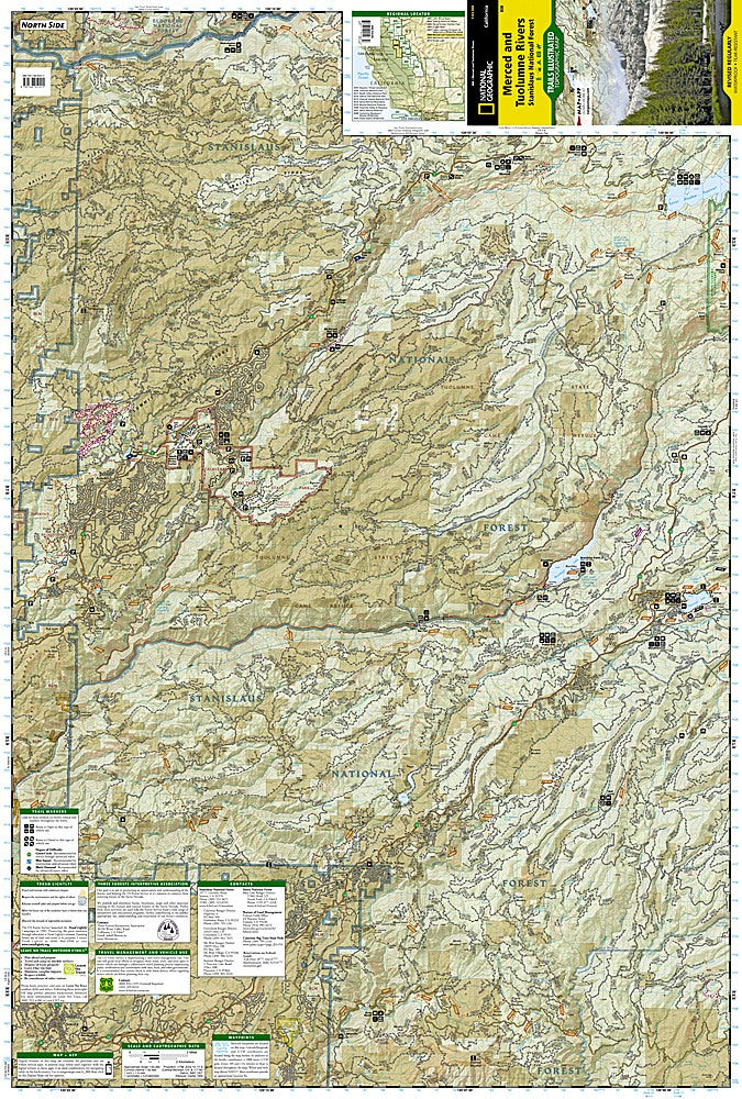
Adventure awaits along the Merced and Tuolumne Rivers! Whether you’re hiking under towering pines, paddling through crystal-clear waters, or chasing the perfect sunset, this National Geographic Trails Illustrated Topographic Map #808 is your ultimate guide to Northern California’s outdoor playground. Covering the scenic corridors just west of Yosemite National Park, the map takes you from the majestic Calaveras Big Trees State Park and its giant sequoias to the sparkling waters of Pinecrest Lake and the serene trails of Spicer Meadow Reservoir. History buffs will love that this region played a key role during the California Gold Rush, and remnants of old mining trails still dot the landscape.
With detailed topography, contour lines, and marked elevations, you can confidently navigate hundreds of miles of trails, Forest Service roads, and scenic byways. Features include camping sites, fishing spots, trailheads, and overlooks. Waterproof, tear-resistant, and GPS-ready with a full UTM grid, this map is perfect for hikers, backpackers, and horseback riders seeking adventure and discovery in the heart of Stanislaus National Forest.
SKU: SKU:TRA808
View full details