National Geographic
Manti-La Sal National Forest Trails Illustrated Topographic Map #703
Manti-La Sal National Forest Trails Illustrated Topographic Map #703
Couldn't load pickup availability
Share
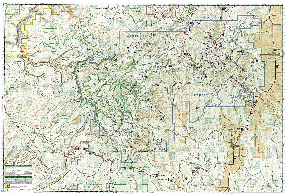
Discover the rugged beauty of southeastern Utah with National Geographic’s Manti-La Sal National Forest Trails Illustrated Topographic Map #703! From the twisting canyons of Dark Canyon Wilderness to the stunning rock formations of Natural Bridges National Monument, this map guides you through some of the region’s most iconic landscapes. Adventure seekers can also explore the remote Blue Mountains or uncover hidden gems like Cheesebox Canyon, all while soaking in centuries of history—from ancient Ancestral Puebloan sites to the storied routes of early explorers.
Designed in cooperation with the U.S. Forest Service and Bureau of Land Management, this map delivers precise topographic detail, clearly marked trailheads, and trail types for hiking, motorcycling, and ATV riding. Elevations, contour lines, water features, numbered Forest Service roads, and waypoints make navigation a breeze. Mileage markers on the Kokopelli Trail and scenic byways like Unaweep-Tabeguache, Bicentennial, and Trail of the Ancients ensure every journey is well-planned.
Printed on waterproof, tear-resistant paper with a full UTM grid, this map is your ultimate companion for off-the-beaten-path exploration in Manti-La Sal National Forest.
SKU: SKU:TRA703
View full details