National Geographic
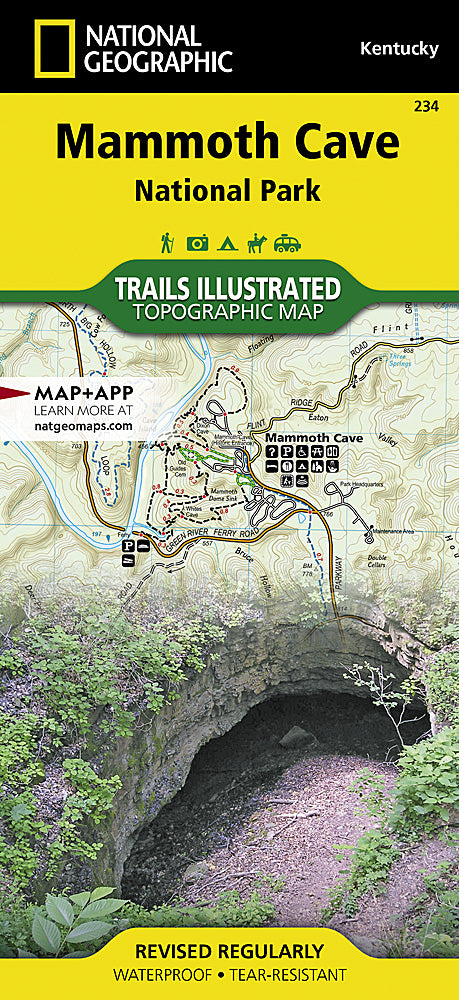
Mammoth Cave National Park Trails Illustrated Topographic Map #234
Mammoth Cave National Park Trails Illustrated Topographic Map #234
Couldn't load pickup availability
Share
Get ready to explore the underground wonderland of Mammoth Cave National Park like a pro! National Geographic’s Trails Illustrated Topographic Map #234 is your ultimate companion for hiking, caving, and river adventures in south-central Kentucky. Covering the world’s longest known cave system and the scenic Green River valley, this map helps you navigate every twist, turn, and trail with confidence.
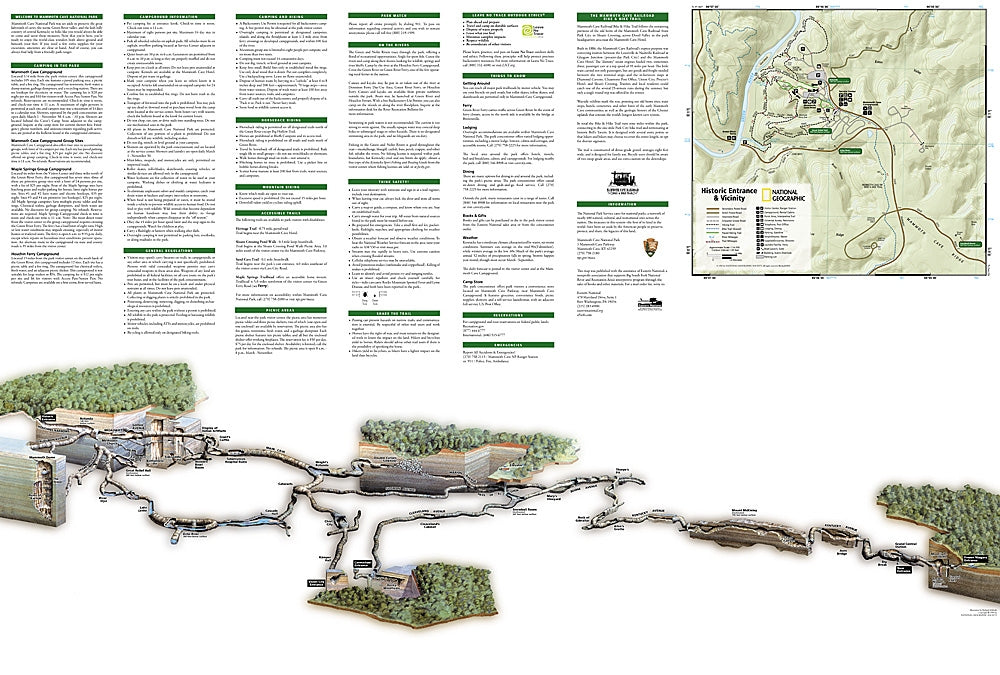
Discover top attractions like the historic Mammoth Cave entrance, the tranquil Green and Nolin Rivers, and First Creek Lake, all while soaking up the area’s rich history—Mammoth Cave has been explored for centuries, from Indigenous peoples to early 19th-century saltpeter miners. This highly detailed map shows trailheads, interpretive trails, contour lines, shaded relief, and elevations, plus park facilities, campgrounds, fishing spots, and river access points.
Printed on waterproof, tear-resistant paper and complete with UTM grids for GPS navigation, this map keeps you on track whether you’re spelunking underground or hiking the surface trails. Adventure awaits—don’t just visit Mammoth Cave, experience it fully with the Trails Illustrated map!
SKU: SKU:TRA234
View full details