National Forest Service
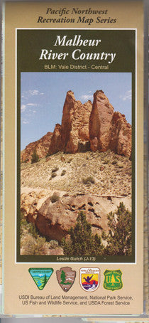
Malheur River Country Recreation Map
Malheur River Country Recreation Map
Couldn't load pickup availability
Share
Discover the remote beauty of eastern Oregon with the Malheur River Country Map from the Pacific Northwest Recreation Map Series. Covering the expansive Malheur National Forest—over 1.4 million acres—this map guides you through high desert plateaus, old-growth pine stands, and the sparkling waters of the North Fork Malheur River.
Explore top attractions like the Strawberry Mountain Wilderness, Magone Lake, and the John Day Fossil Beds. Spot elk, mule deer, golden eagles, and wildflowers like lupine and Indian paintbrush along your journey. Rich in history, the region was once home to the Paiute people and later explored by settlers on the Oregon Trail. Located in southeastern Oregon, just west of the Owyhee Uplands, this map is your gateway to rugged solitude, breathtaking views, and quiet campsites.
Whether hiking, fishing, or simply soaking in the natural wonder, this map will help you plan an unforgettable backcountry escape.
SKU: SKU:NFORMAL
View full details