National Geographic
Los Padres National Forest West Trails Illustrated Topo Map #813
Los Padres National Forest West Trails Illustrated Topo Map #813
Couldn't load pickup availability
Share
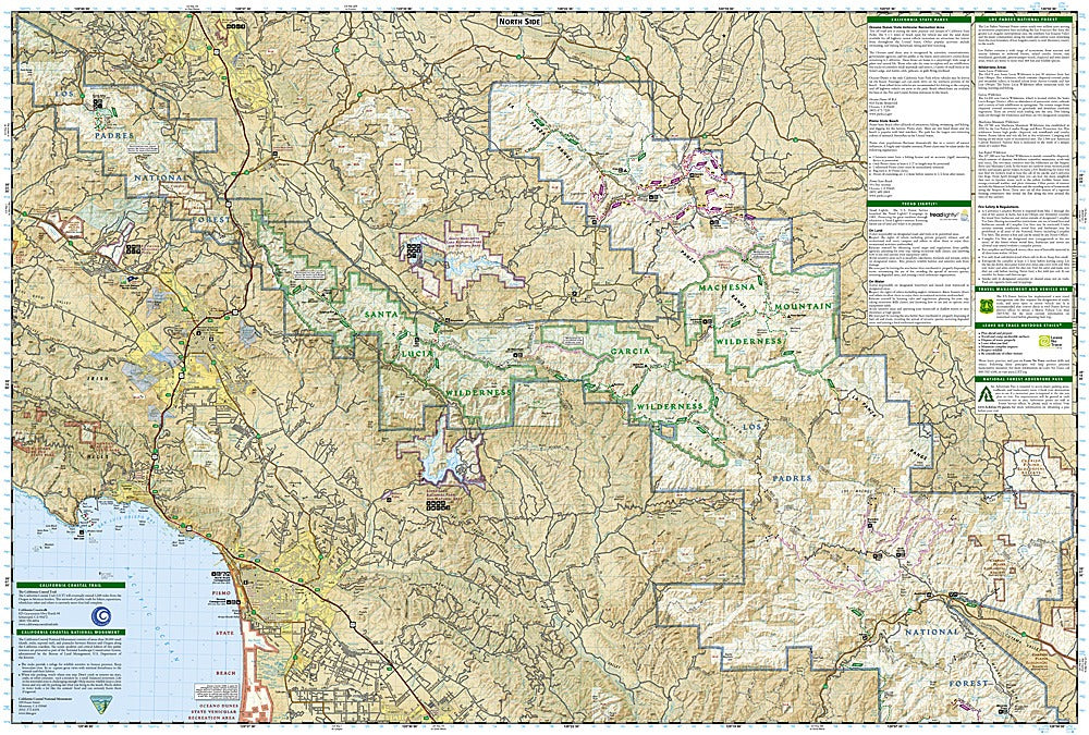
Get ready to explore the wild and wondrous landscapes of California with the Los Padres National Forest West Trails Illustrated Topographic Map #813 by National Geographic! Perfect for hikers, horseback riders, and adventure seekers, this map puts you at the heart of over 700,000 acres of stunning terrain, from sun-drenched coastal beaches to serene oak woodlands and rugged chaparral hills.
Discover top attractions like the scenic Gaviota State Park, the fascinating Chumash Painted Cave State Historic Park, and the sparkling waters of Lake Cachuma. Trace the paths of the Sisquoc Wild and Scenic River or plan a getaway to the Oceano Dunes State Vehicular Recreation Area. Rich in history, this region was home to the Chumash people for thousands of years, and remnants of their culture still inspire visitors today.
With detailed contour lines, shaded relief, mapped trails for hiking, horseback riding, and OHV use, plus campgrounds, boat launches, and scenic byways noted, this waterproof, tear-resistant map keeps you on track no matter the adventure. Navigate confidently with its full UTM grid and explore Los Padres like never before!
SKU: SKU:TRA813
View full details