National Geographic
Los Padres National Forest East Trails Illustrated Topo Map #812
Los Padres National Forest East Trails Illustrated Topo Map #812
Couldn't load pickup availability
Share
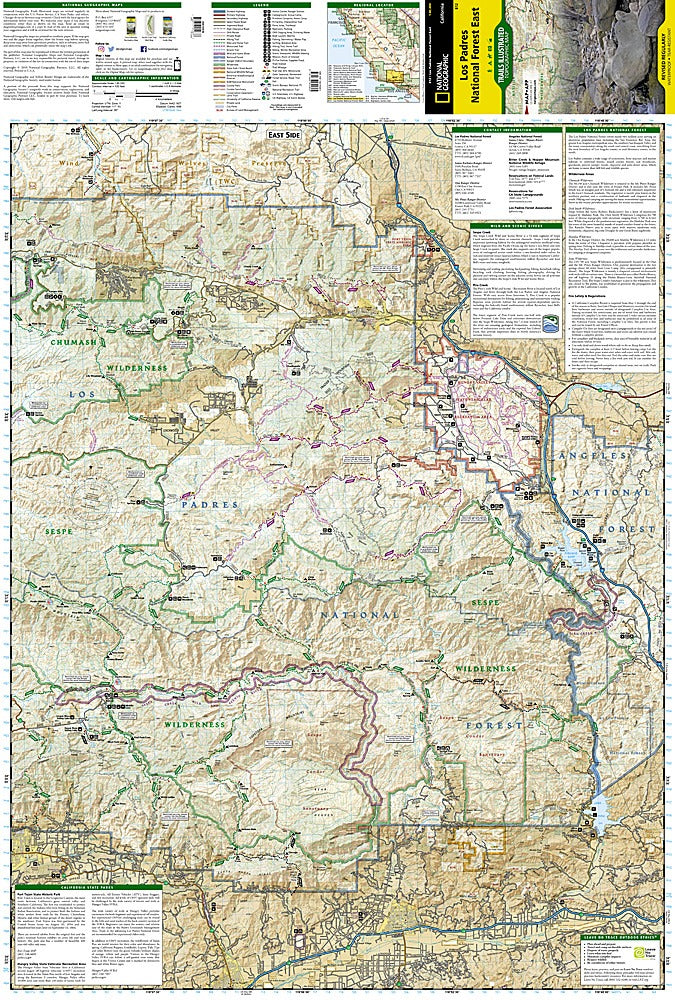
Get ready to explore one of California’s most breathtaking playgrounds with National Geographic’s Los Padres National Forest East Trails Illustrated Topographic Map #812! Whether you’re chasing epic hikes, horseback adventures, or river swims, this map is your ultimate trail companion. Covering the vast stretch from Santa Barbara to the Angeles National Forest boundary, it highlights must-see spots like the historic Fort Tejon, the stunning Sespe Wilderness, and the scenic Carpinteria State Beach.
Delve into the region’s rich past, from Chumash heritage sites to Spanish-era El Presidio de Santa Barbara, while navigating hundreds of miles of trails, rivers, and peaks. Contour lines, labeled summits, water features, Forest Service roads, and OHV routes make planning any adventure a breeze. With color-coded land management boundaries and mileage markers, you’ll know exactly where you are and where to go next.
Printed on waterproof, tear-resistant “Backcountry Tough” paper with a full UTM grid for GPS users, this map is built to handle every rugged journey. Your next Los Padres adventure starts here!
SKU: SKU:TRA812
View full details