National Geographic
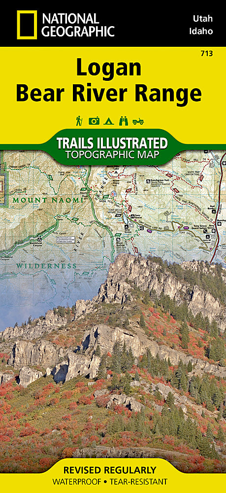
Logan & Bear River Range Trails Illustrated Topographic Map #713
Logan & Bear River Range Trails Illustrated Topographic Map #713
Couldn't load pickup availability
Share
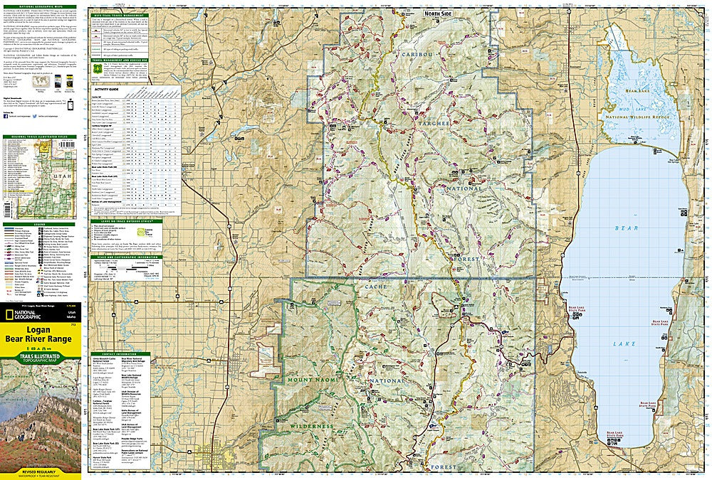
Get ready to explore the rugged beauty of northeastern Utah and southeastern Idaho with the Logan & Bear River Range Trails Illustrated Topographic Map #713 by National Geographic! Perfect for hikers, backpackers, and outdoor enthusiasts, this map is your ultimate guide to the Bear River Mountains, a landscape rich in scenic peaks, sparkling lakes, and hidden wildlife havens.
Discover must-see highlights like Bear Lake National Wildlife Refuge, Hardware Ranch State Wildlife Area, and the towering Wellsville Mountain Wilderness, all while tracing historic trails that echo the region’s pioneer past. Navigate with ease across Mount Naomi Wilderness, Bear River, and the vibrant towns of Logan, Hyrum, and Smithfield using detailed trails, contour lines, and trail mileage between intersections.
Printed on durable, waterproof “Backcountry Tough” paper and complete with GPS-ready UTM grids, this map helps you tackle everything from day hikes to extended backcountry adventures. Venture off the beaten path with confidence and make every trek unforgettable!
SKU: SKU:TRA713
View full details