National Geographic
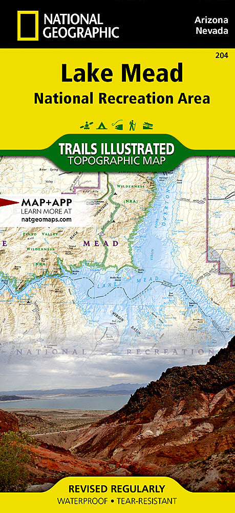
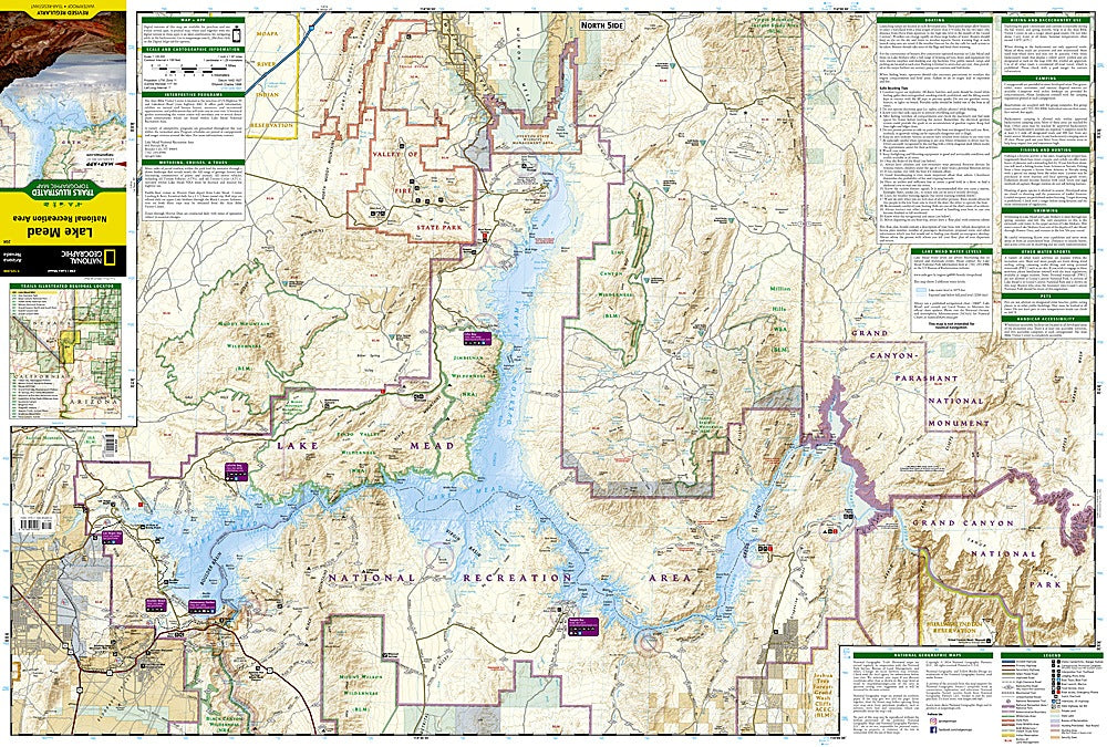
Lake Mead Recreation Area Trails Illustrated Topographic Map #204
Lake Mead Recreation Area Trails Illustrated Topographic Map #204
Couldn't load pickup availability
Share
Get ready to uncover the wild beauty of Lake Mead National Recreation Area with National Geographic’s Trails Illustrated Topographic Map #204—the ultimate guide for hikers, adventurers, and outdoor explorers! Straddling the Arizona & Nevada border, this 1.5 million-acre desert wonderland showcases three of America’s iconic desert ecosystems: the Mojave, Great Basin, and Sonoran.
Navigate effortlessly to top attractions like the dazzling Valley of Fire State Park, the engineering marvel of Hoover Dam, and the serene trails of Mount Wilson Wilderness. Explore historic sites, hidden coves, and scenic overlooks while discovering the rich history of the area, from early Native American settlements to modern recreational developments.
Packed with detailed topography, shaded relief, trailheads, campgrounds, and boating facilities, plus safety tips and UTM grids for GPS use, this “Backcountry Tough” waterproof, tear-resistant map ensures you’re prepared for every adventure. Whether hiking, boating, or exploring by car, your Lake Mead adventure starts here!
SKU: SKU:TRA204
View full details