National Geographic
Kenai National Wildlife Refuge Trails Illustrated Topographic Map #760
Kenai National Wildlife Refuge Trails Illustrated Topographic Map #760
Couldn't load pickup availability
Share
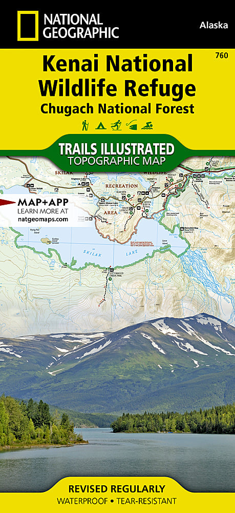
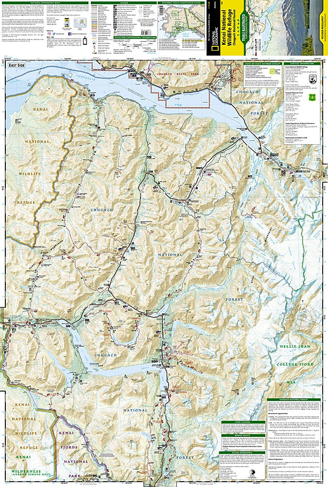
Discover Alaska’s wild side with the Kenai National Wildlife Refuge Trails Illustrated Topographic Map #760 by National Geographic – your must-have guide to adventure on the Kenai Peninsula. Whether you’re paddling the Swanson River canoe route, hiking around breathtaking Skilak Lake, or spotting moose and bears in the Kenai Mountains, this map leads the way.
The Kenai Refuge is a land of rugged peaks, glacier-fed lakes, and rich history—once home to Alaska’s early Native peoples and traversed by gold seekers on their way to Seward and beyond. Today, it’s a playground for hikers, anglers, and wildlife lovers. With detailed topography, mileage-marked trails, campsites, boating routes, and GPS-ready grids, you’ll be set to explore everything from the Iditarod National Historical Trail to the scenic Sterling Highway.
Printed on waterproof, tear-resistant paper, this map is built as tough as the terrain it covers—so you can adventure with confidence.
SKU: SKU:TRA760
View full details