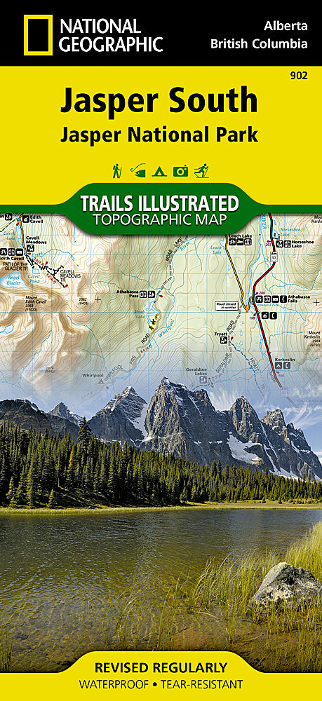
National Geographic
Jasper National Park, South Trails Illustrated Topographic Map #902
Jasper National Park, South Trails Illustrated Topographic Map #902
Couldn't load pickup availability
Share
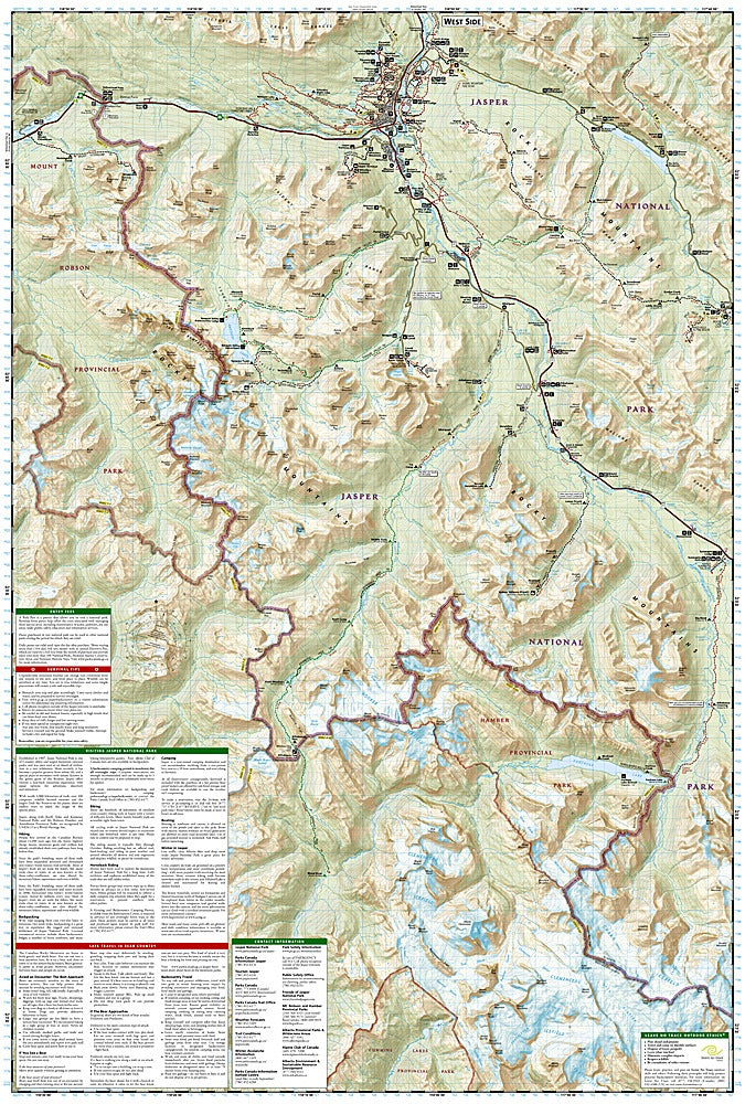
Get ready to explore the wild heart of the Canadian Rockies with National Geographic’s Jasper National Park South Trails Illustrated Map #902! Whether you’re chasing roaring waterfalls, stunning canyons, or pristine alpine lakes, this map puts the park at your fingertips. Hike to Athabasca and Sunwapta Falls, wander through Maligne Canyon and Lake, or discover the serene Medicine Lake—all with trails, distances, and usage clearly marked.
Jasper National Park, a UNESCO World Heritage Site, has been protecting rugged peaks, glaciers, and wildlife since 1907, offering hikers, bikers, and horseback riders endless adventure. This map covers everything from the town of Jasper to the Victoria Cross Ranges and beyond, including nearby Mount Robson and Hamber Provincial Parks, plus the northwestern corner of Banff National Park.
Printed on waterproof, tear-resistant “Backcountry Tough” paper, with contour lines, labeled peaks, scenic roads, and a full UTM grid for GPS navigation, this map is your ultimate companion for exploring Jasper’s breathtaking trails.
SKU: SKU:TRA902
View full details