National Geographic
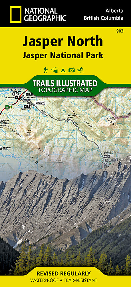
Jasper National Park, North Trails Illustrated Topographic Map #903
Jasper National Park, North Trails Illustrated Topographic Map #903
Couldn't load pickup availability
Share
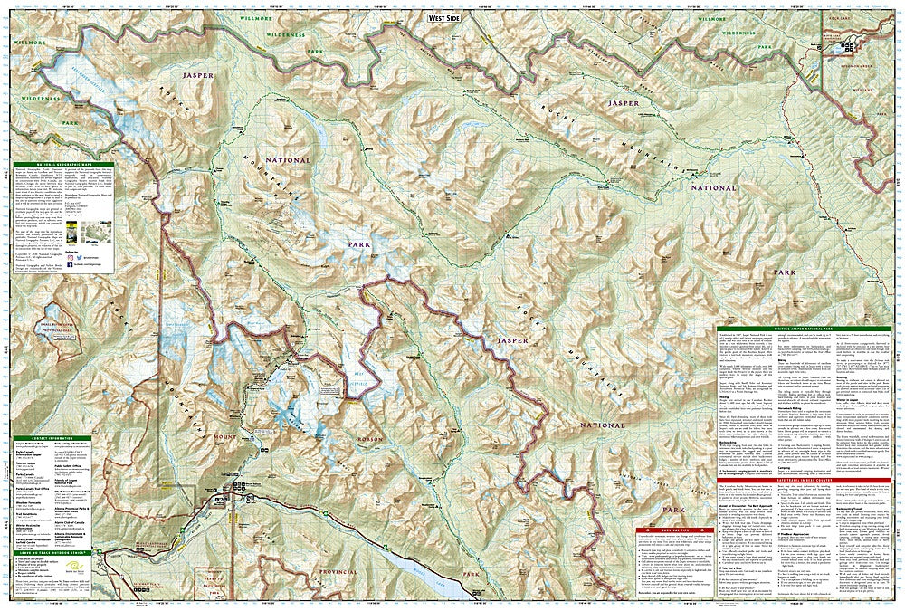
Ready to conquer the Canadian Rockies? National Geographic’s Jasper National Park North Trails Illustrated Map #903 is your ultimate adventure companion, guiding you through one of North America’s most stunning landscapes. From the bubbling Miette Hot Springs to the dramatic Maligne Canyon and the serene Pyramid Lake, this map unlocks the park’s must-see natural wonders while giving you a clear sense of its rich history and geography.
Covering the park from the town of Jasper to its northern reaches, including nearby Mount Robson Provincial Park and Willmore Wilderness Park, it shows every trail, contour, glacier, river, and wooded area in meticulous detail. Color-coded trails, distance markers, and recreation features—from backcountry camps to scenic viewpoints—make planning your hike, horseback ride, or bike trip a breeze.
Printed on waterproof, tear-resistant “Backcountry Tough” paper and complete with a full UTM grid for GPS navigation, this map is built to survive your wildest adventures in the Rockies.
SKU: SKU:TRA903
View full details