International Travel Maps
Jamaica & Cayman Islands Travel & Reference Map by ITMB
Jamaica & Cayman Islands Travel & Reference Map by ITMB
Couldn't load pickup availability
Share
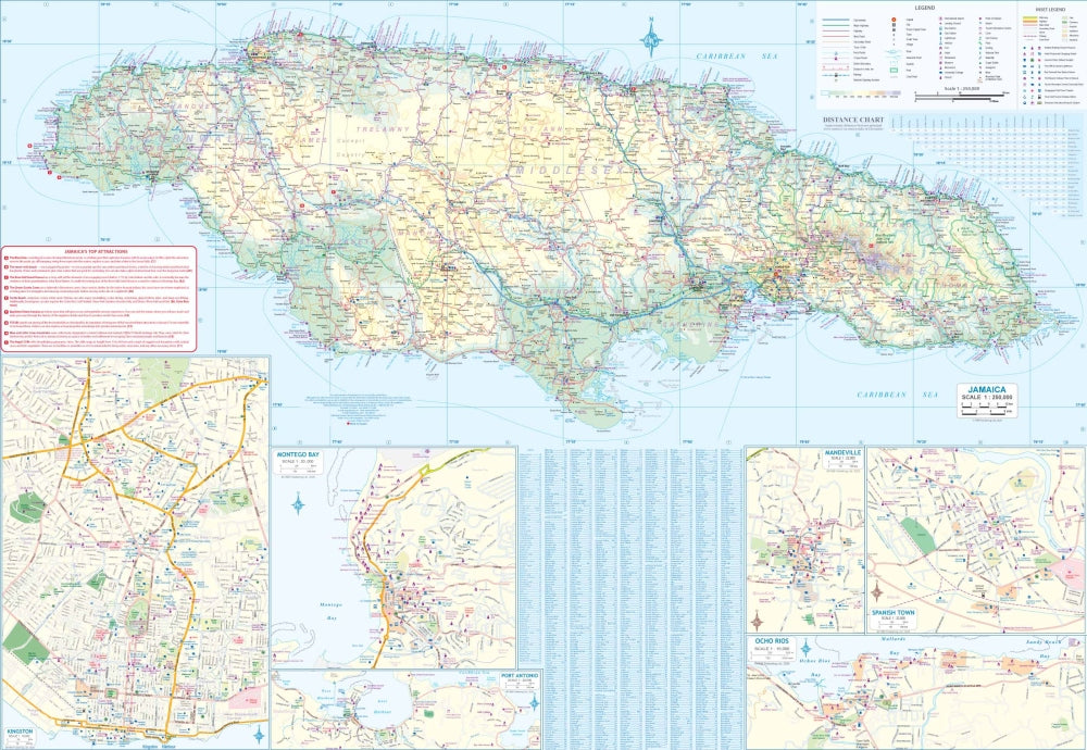
Discover two tropical gems in one handy fold-out! The double-sided Jamaica & Cayman Islands Travel & Reference Map by ITMB captures the vibrant beauty and adventure of both destinations at scales of 1:125,000 and 1:37,500. On Side 1, explore Jamaica’s lush mountains, rivers, and beaches with detailed mapping of Kingston, Montego Bay, Ocho Rios, Mandeville, Port Antonio, and Spanish Town. Cruise the north coast for reggae rhythms, Dunn’s River Falls, and the historic Rose Hall Great House.
Flip to Side 2 and dive into the British charm of the Cayman Islands, featuring Grand Cayman, Little Cayman, and Cayman Brac. Navigate your way to Seven Mile Beach, spot marine life at Stingray City, or visit the eerie limestone landscape of Hell. Perfect for travelers, divers, and cruisers alike, this 27" x 39" waterproof map includes roads, airports, national parks, and points of interest—everything you need for sun-soaked exploration. Adventure meets accuracy in this colorful Caribbean companion!
SKU: SKU:ITMJAM
View full details