1
/
of
2
Fine Edge
Inside Passage Map - North Half
Inside Passage Map - North Half
Regular price
$24.95 USD
Regular price
Sale price
$24.95 USD
Unit price
/
per
Couldn't load pickup availability
Share
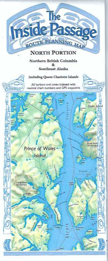
Large islands an snow-clad mountains characterize the northern British Columbia and Alaskan coastal waterways. This beautiful map covers from Glacier Bay and Skagway, Alaska, to Aristazabel and Prince Royal Islands, including all of the Queen Charlotte Islands. Details include express and scenic cruising routes, latitude and longitude grids and place names. The back has an index of place names complete with latitude and longitude and US or Canadian chart numbers. Not legal for navigation, but great for planning or decorating!
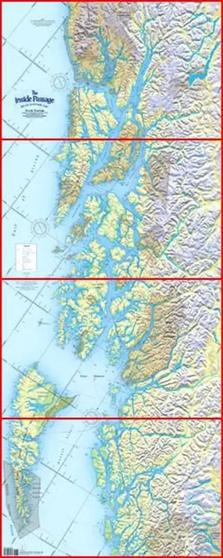
Available folded up in paper or rolled laminated. Note: The red lined pictured here are not on the map and laminated maps were previously folded. Slight creases can be seen / felt.
Match lines allow this map to be joined with Inside Passage - South half for a total height of 111 inches. Scale = 1:633,600.
SKU: SKU:FEPIPNF
View full details