1
/
of
1
Ice Age Floods Institute
Ice Age Floods in the Pacific Northwest Map
Ice Age Floods in the Pacific Northwest Map
Regular price
$26.95 USD
Regular price
Sale price
$26.95 USD
Unit price
/
per
Couldn't load pickup availability
Share
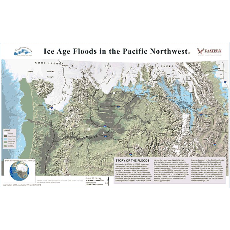
This beautiful full color Glacial Lake Missoula map has been updated. This new map shows the locations of the glaciers during the last glacial cycle, Glacial Lake Missoula and Glacial Lake Columbia, the area inundated during the megafloods of the Ice Age, and the location of the greatly reduced sea level during the glacial maximum. Considerable details of topography, roads, and numerous towns and cities have been added.
Size: 36" x 24"
SKU: SKU:IAIGLM
View full details