National Geographic
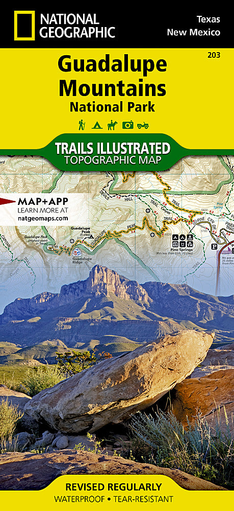
Guadalupe Mountains National Park Trails Illustrated Topo Map #203
Guadalupe Mountains National Park Trails Illustrated Topo Map #203
Couldn't load pickup availability
Share
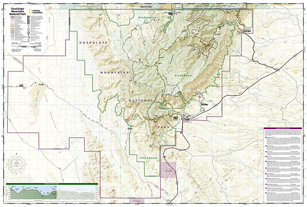
Explore the rugged beauty of West Texas with National Geographic’s Trails Illustrated Topographic Map #203 of Guadalupe Mountains National Park. This detailed map is your ultimate guide to hiking, camping, and discovering the park’s stunning landscapes, including the towering Guadalupe Peak, the dramatic El Capitan, and the historic Pine Springs Visitor Center.
Hike trails that wind through diverse ecosystems, from desert lowlands to lush mountain forests, while spotting native wildlife like javelinas, roadrunners, and vibrant wildflowers. Rich in history, the park preserves remnants of early ranching and frontier life, and its dramatic geology dates back nearly 300 million years, revealing ancient reef formations and limestone cliffs. Complete with contour lines, elevations, water features, mileage markers, and color-coded trails, this map also includes campgrounds, picnic areas, and access to nearby Carlsbad Caverns National Park.
Printed on waterproof, tear-resistant “Backcountry Tough” paper, it’s a durable companion for every outdoor adventure.
SKU: SKU:TRA203
View full details