Kroll Map Company
Greater Puget Sound Arterial Wall Map
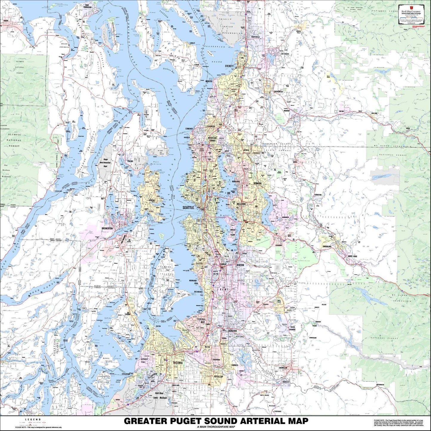
Greater Puget Sound Arterial Wall Map
Couldn't load pickup availability
Share
This 36" x 41" Map of Puget Sound by Kroll Map Company, is a carefully crafted Greater Puget Sound Arterial Wall Map that seamlessly combines detailed cartography with aesthetic design. Covering an expansive region from Marysville south to Tacoma and Bremerton east to Gold Bar, and extending further east to the fringes of the National Forest, this map is the perfect tool to illustrate the geographical intricacies of the Puget Sound area.
The Map of Puget Sound offers a comprehensive overview of the main thoroughfares, cities, highways, interstates, unincorporated place names, parks, and golf courses in the Greater Puget Sound region. Whether you're a local resident, a commuter, or a visitor exploring this vibrant part of the Pacific Northwest, this map provides essential geographic insights.
Careful text placement and an attractive color scheme enhance the accuracy and usability of this map. The layout has been thoughtfully designed to ensure ease of use and readability, allowing you to quickly locate and comprehend the geographical relationships between various locations in the area.
Whether you're planning a road trip, navigating daily commutes, or simply exploring the diverse offerings of Puget Sound, this wall Map of Puget Sound is an indispensable reference. Display it in your home, office, or classroom to gain a deeper appreciation of the Greater Puget Sound area's unique geography and charm. Explore the beauty of Puget Sound and immerse yourself in the rich tapestry of this captivating region, and let this Map of the Puget Sound be your guide to a deeper understanding of the place we call home.
SKU: SKU:KROGPSM
View full details