Mitchell Geography
Glaciers of Mount Hood Souvenir & Reference Map
Glaciers of Mount Hood Souvenir & Reference Map
Couldn't load pickup availability
Share
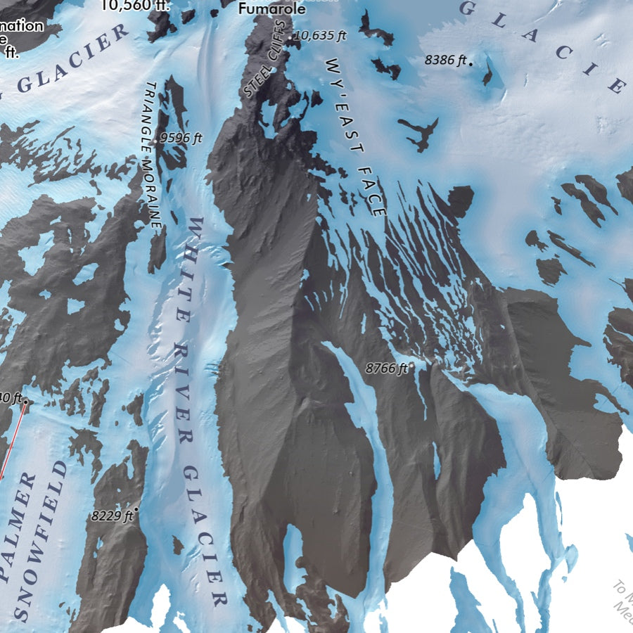
Adventure starts at the summit! The Glaciers of Mount Hood Souvenir & Reference Map turns Oregon’s most iconic peak into a stunning wall-worthy keepsake packed with rugged alpine detail and explorer appeal.
Printed on heavy fine paper in a striking 13" x 19" format, this beautifully updated 2024 map showcases Mount Hood’s glaciers, snowfields, chutes, ridges, and volcanic landforms using Oregon DOGAMI’s advanced LiDAR elevation model. From the legendary Timberline Lodge to the historic Silcox Hut, every contour invites outdoor lovers, skiers, climbers, and Pacific Northwest travelers deeper into the mountain’s dramatic terrain. Even Timberline’s upper chairlifts and the famed Palmer route are clearly mapped for added adventure inspiration.
Mount Hood itself is a dormant stratovolcano and the tallest peak in Oregon, rising 11,249 feet above the Cascade Range since its last eruptive period in the 1800s. Featuring landmarks like Cooper Spur and the sprawling Eliot Glacier, this detailed reference map makes an unforgettable souvenir, educational display, and conversation-starting piece of mountain art.
SKU: SKU:PMGORMH01
View full details