Mitchell Geography
Glaciers of Mount Baker Souvenir & Reference Map
Glaciers of Mount Baker Souvenir & Reference Map
Couldn't load pickup availability
Share
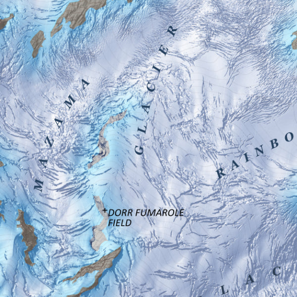
Witness the icy drama of the Pacific Northwest in spectacular detail with the Glaciers of Mount Baker Souvenir & Reference Map. This eye-catching map turns one of Washington’s most glacier-covered volcanoes into a stunning piece of wall art and an informative geographic snapshot.
Centered on Mount Baker—also known as Kulshan—this beautifully rendered map reveals the mountain’s massive glaciers, intricate icefalls, and rugged alpine terrain using a high-resolution 3-foot LiDAR-derived terrain model. Color-shaded relief brings the landscape to life, highlighting crevasses, bergschrunds, ridges, moraines, and sub-peaks in vivid detail.
The area has long fascinated explorers and scientists; Mount Baker’s glaciers have been studied for over a century as indicators of climate change and volcanic activity in the Cascades.
Printed on heavy fine paper in either 13" x 19" with slightly fewer names labeled (WA state image on top right) or 20" x 24", this vibrant map is perfect for hikers, climbers, and collectors who love Pacific Northwest mountain landscapes.
SKU: SKU:PMG2X0020
View full details