Mitchell Geography
Glaciers of Mount Adams Souvenir & Reference Map
Glaciers of Mount Adams Souvenir & Reference Map
Couldn't load pickup availability
Share
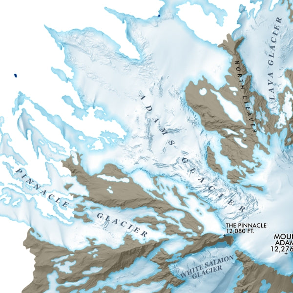
Towering ice fields, volcanic landscapes, and legendary Pacific Northwest adventure come together in this striking Glaciers of Mount Adams Souvenir & Reference Map! Designed to inspire explorers, hikers, climbers, and map lovers alike, this 13" x 19" print transforms one of Washington’s most iconic peaks into a stunning keepsake worthy of display.
Featuring detailed coverage of Mount Adams’ glaciers, summit terrain, and surrounding geography, this map highlights the famous South Climb Trail (but not the alpine route beyond the official USFS trail), along with key volcanic features that define the mountain’s rugged beauty. Mount Adams, the second-highest peak in Washington State, is part of the Cascade Volcanic Arc and was considered spiritually significant by Native peoples long before modern mountaineering began. Famous destinations like the South Climb route and the sprawling Adams Glacier make this map both an informative reference and a memorable souvenir.
Printed on heavy fine paper with crisp detail and bold cartographic styling, it’s the perfect gift for hikers, climbers, travelers, and Pacific Northwest adventure enthusiasts.
SKU: SKU:PMGWAAD01
View full details