1
/
of
1
Green Trails
Glacier Peak, WA - Green Trails Map 112
Glacier Peak, WA - Green Trails Map 112
Regular price
$8.00 USD
Regular price
Sale price
$8.00 USD
Unit price
/
per
Couldn't load pickup availability
Share
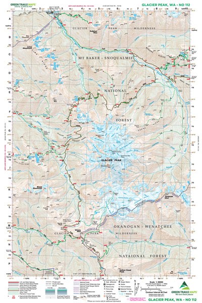
Glacier Peak, WA - Green Trails Map #112 provides a detailed guide to Washington’s wildest volcano, Glacier Peak, standing at 10,541 feet. This map covers the entire remote peak, making it an excellent resource for climbers and backpackers. The Pacific Crest Trail is highlighted as it winds along the volcano’s western slopes from Indian Head Peak to Miners Creek. Also featured are the Suiattle River Trail, Miners Ridge, Image Lake, and routes to Lake Byrne, Fire Mountain, and Sulphur Mountain. Scramblers will appreciate coverage of Lime Ridge’s alpine lakes. Designed for adventure, this map is essential for navigating Glacier Peak’s rugged backcountry.
Green Trail Maps are easy to use hiking maps that have topographical information, backroads, trails, campsites, information about winter recreation, and more. Green Trail Maps show hiking trails clearly marked in green, with trail distances also listed. Most maps are at a scale of 1:69,500.
Available in paper or laminated versions. The laminate is thin so it is easily foldable. Some titles are printed on waterproof paper so we don't offer them laminated.
Available in paper or laminated versions. The laminate is thin so it is easily foldable. Some titles are printed on waterproof paper so we don't offer them laminated.
SKU: SKU:GRE112
View full details