1
/
of
2
USGS
Geologic Map of the North Cascades
Geologic Map of the North Cascades
Regular price
$34.95 USD
Regular price
Sale price
$34.95 USD
Unit price
/
per
Couldn't load pickup availability
Share
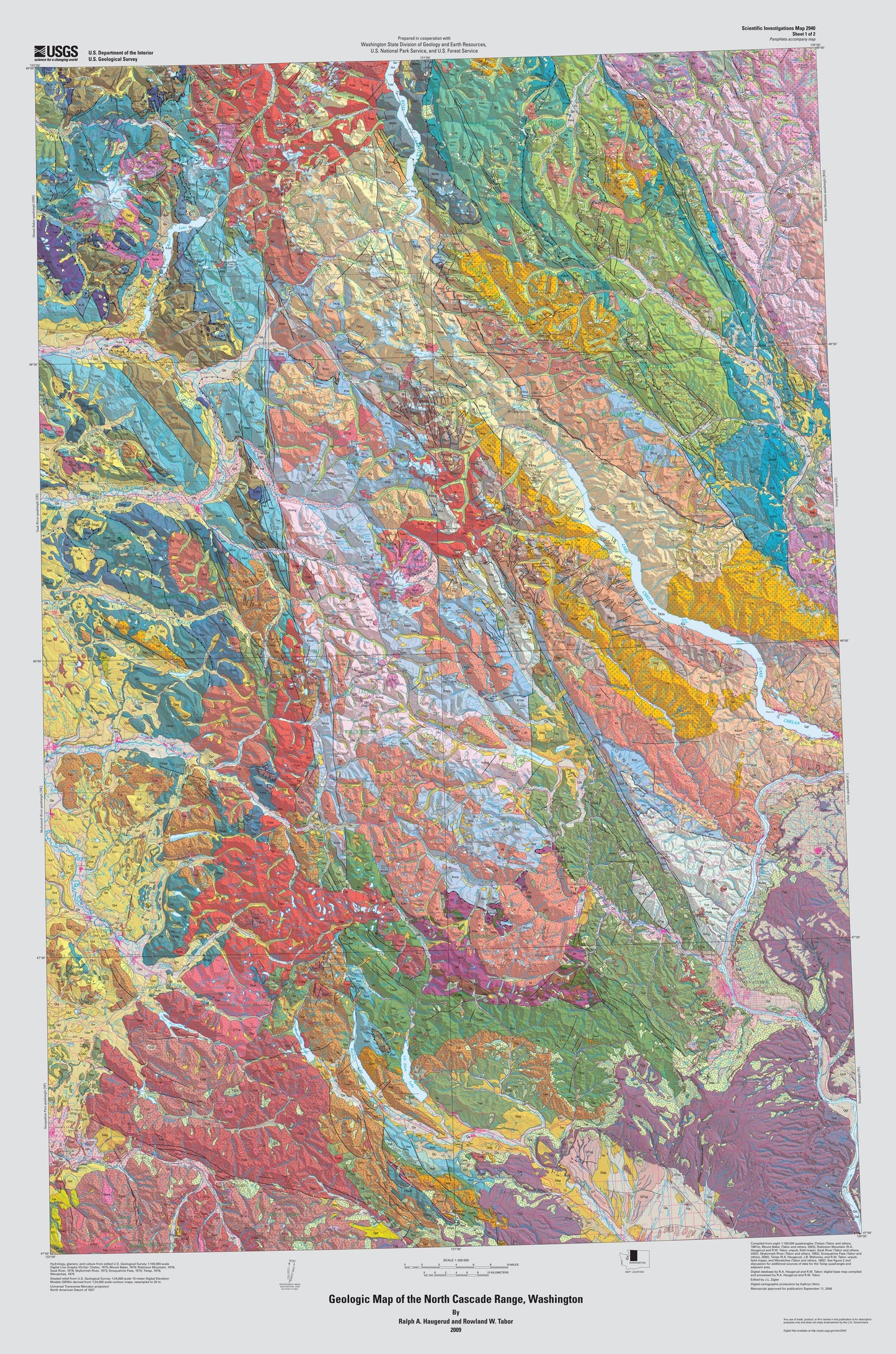
To quote from the USGS description of this map: "The North Cascades are generally characterized by exposure of plutonic and metamorphic rocks in contrast to the volcanic terrain to the south. The rocks of the North Cascades are more resistant to erosion, display greater relief, and show evidence of more pronounced uplift and recent glaciation. Although the total length of the North Cascade Range, extending north from Snoqualmie Pass in Washington, is about 200 mi (320 km), this compilation map at 1:200,000 scale covers only that part (~150 mi) in the United States. The compilation map is derived mostly from eight 1:100,000-scale quadrangle maps that include all of the North Cascade Range in Washington and a bit of the mostly volcanic part of the Cascade Range to the south. Overall, the area represented by this compilation is about 12,740 mi. The superb alpine scenery of the North Cascade Range and its proximity to major population centers has led to designation of much of the area for recreational use or wilderness preservation. A major part of the map area is in North Cascade National Park. Other restricted use areas are the Alpine Lakes, Boulder River, Clearwater, Glacier Peak, Henry M. Jackson, Lake Chelan-Sawtooth, Mount Baker, Noisy-Diobsud, Norse Peak, and Pasayten Wildernesses and the Mount Baker, Lake Chelan, and Ross Lake National Recreation Areas. The valleys traversed by Washington State Highway 20 east of Ross Lake are preserved as North Cascades Scenic Highway. The map area is traversed by three major highways: U.S. Interstate 90, crossing Snoqualmie Pass; Washington State Highway 2, crossing Stevens Pass; and Washington State Highway 20, crossing Washington Pass."
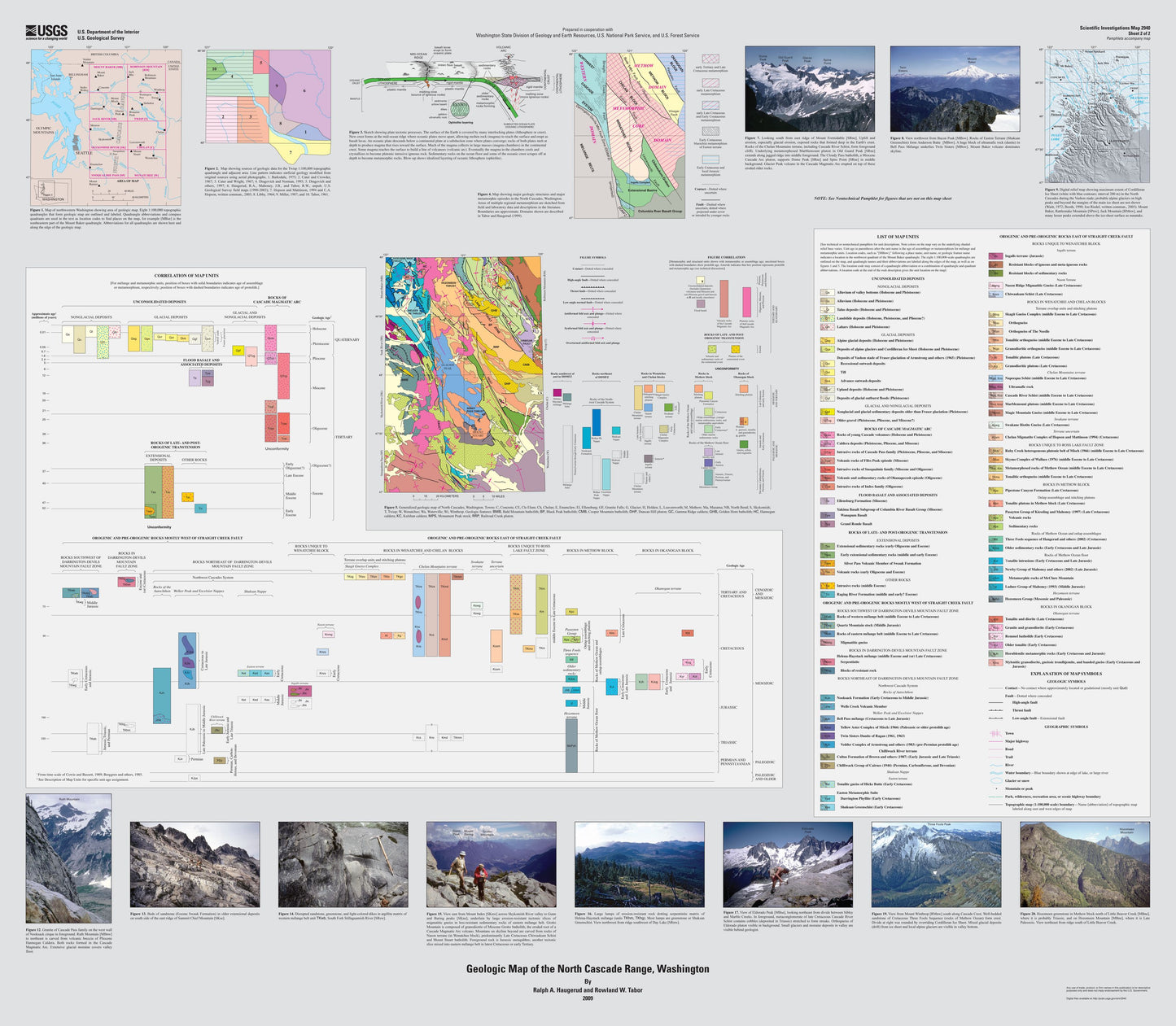
Note: This map consists of 2 Sheets: Sheet 1 (the map itself) is 35.5 x 52.5 inches, Sheet 2 - (the index/key) is 45.5 x 40 inches.
SKU: SKU:USG242360
View full details