KR Maps
Flight Path World Map
Flight Path World Map
Couldn't load pickup availability
Share
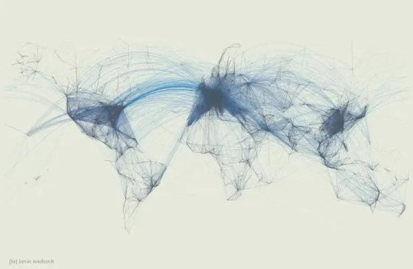
Flight Routes World Map...Great gift for a pilot or airline employee, a world traveller, or lovers of data visualization. Showing worldwide flight patterns and airline routes across the world, the poster illuminates the world's landmasses, population centers, and the paths between those centers. Comes in two different color schemes.
Designed by KR Maps 2016. This map features over 60,000 flight routes around the world, and utilizes over 6,000 different airports as start and end points for the lines.
- No continental boundaries were used. It is simply the combination of color, transparency and thickness of flying patterns which cause the extents of cities, countries and continents to emerge.
- The extremely fine detail of the lines are exposed the closer you observe individual paths, and many of them can be easily traced from one city to another.
Images are printed on a thick matte paper...36" x 24"
SKU: SKU:KRMFP-Color
View full details