National Geographic
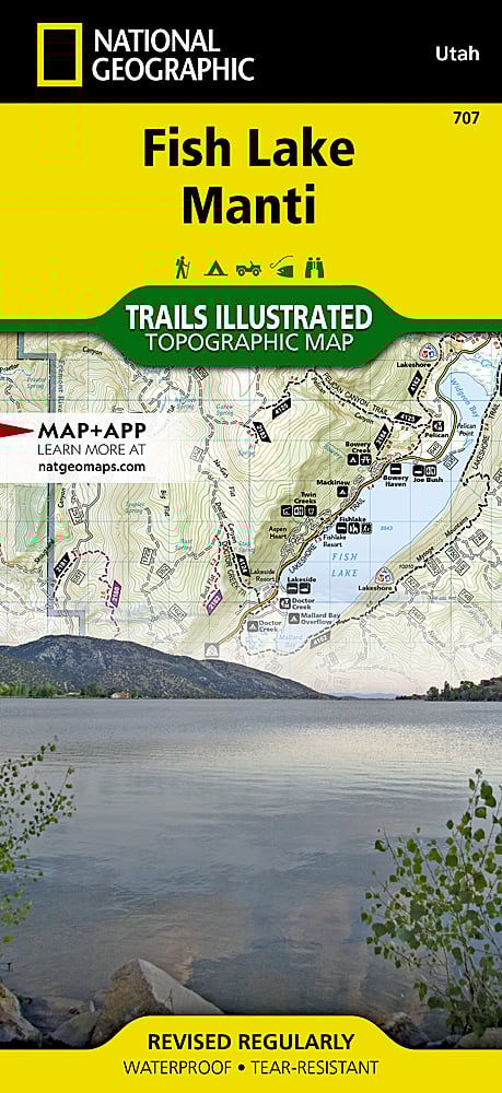
Fish Lake & Manti-La Sal NF Trails Illustrated Topographic Map #707
Fish Lake & Manti-La Sal NF Trails Illustrated Topographic Map #707
Couldn't load pickup availability
Share
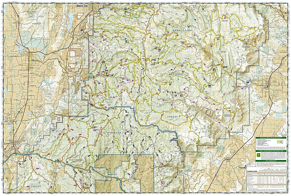
The Fish Lake & Manti-La Sal National Forest Trails Illustrated Topographic Map #707 by National Geographic is the ultimate guide for outdoor enthusiasts exploring central Utah’s rugged landscapes.
Covering the stunning Fish Lake area, this map highlights the famous Paiute ATV Trail, stretching from Koosharem to Salina, as well as the Arapeen and Gooseberry Trail Systems with hundreds of miles of off-road adventure. History buffs will enjoy exploring the routes once traveled by early Mormon pioneers, while modern visitors can follow the historic Great Western Trail that connects Canada to Mexico.
Top attractions include scenic Fish Lake itself, known for trophy lake trout, the Skyline Drive Scenic Backway with panoramic alpine views, and the quiet mountain town of Manti, gateway to the forest. Each trail is clearly marked by use, staging areas are easy to locate, and road and trail mileages simplify trip planning. Waterproof, tear-resistant, and GPS-ready, this map is built for adventure.
SKU: SKU:TRA707
View full details