1
/
of
2
National Geographic
England & Wales Wall Map by National Geographic
England & Wales Wall Map by National Geographic
Regular price
$26.95 USD
Regular price
Sale price
$26.95 USD
Unit price
/
per
Couldn't load pickup availability
Share
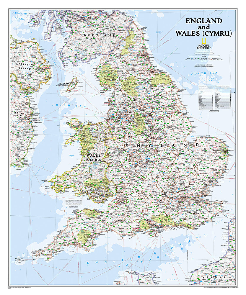
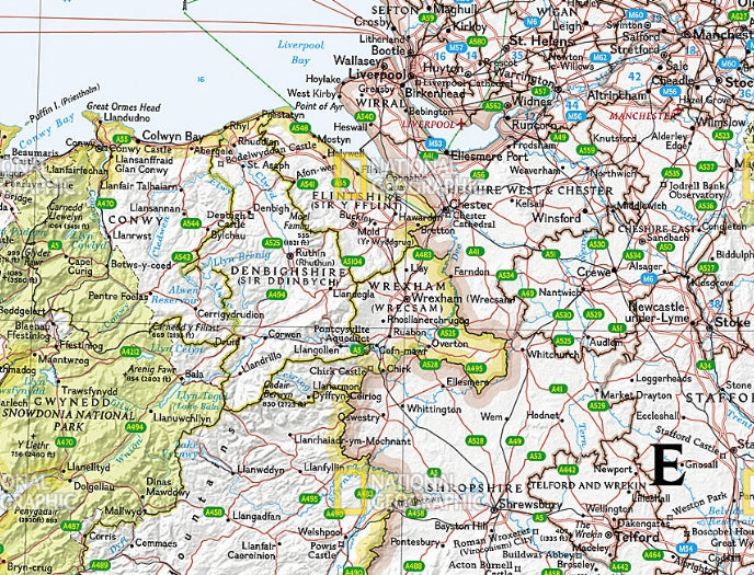
Bring the beauty and history of Great Britain to your wall with the England & Wales Wall Map by National Geographic. Expertly crafted in the signature Classic style, this 30" x 36" map highlights the rich landscapes of England and Wales (Cymru) in stunning shaded relief, from the rugged Snowdonia peaks to the rolling Cotswolds.
Thousands of place names, national parks, rivers, and historic sites are clearly labeled, while roads, motorways, canals, ferry routes, and high-speed railways offer a full picture of the region’s connections. A unique detail you’ll find is the depiction of Wales’ Cambrian Mountains, often called the “backbone of Wales,” which supply water to much of the country.
With bright colors, detailed bathymetry, and coverage that extends into Scotland, Ireland, and France, this map is both a decorative centerpiece and an educational resource. Perfect for home, office, or classroom, it inspires travel, learning, and discovery.
Articles
SKU: SKU:NGSEW
View full details