National Geographic
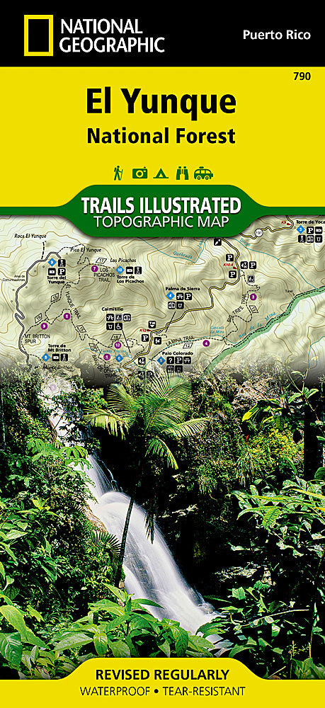
El Yunque National Forest Trails Illustrated Topographic Map #790
El Yunque National Forest Trails Illustrated Topographic Map #790
Couldn't load pickup availability
Share
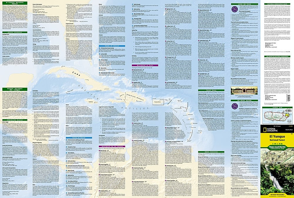
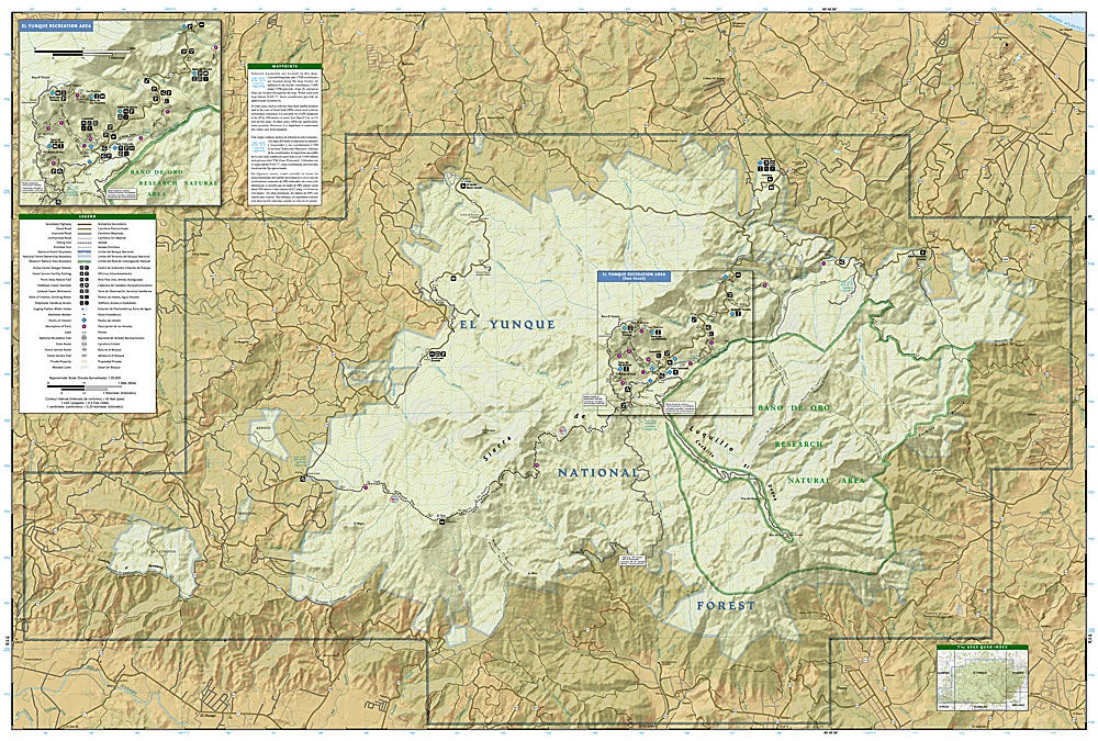
El Yunque National Forest, the only tropical rainforest in the U.S. National Forest System, comes alive with the El Yunque National Forest Trails Illustrated Topographic Map #790 by National Geographic. Covering the lush peaks of eastern Puerto Rico, this waterproof, tear-resistant map is your key to exploring one of the most biodiverse areas in the Caribbean.
Hike to La Mina Falls, a sparkling jungle cascade, take in sweeping views from Yokahú Tower, or wander the historic Baño de Oro Natural Area, once the site of a Civilian Conservation Corps recreation facility from the 1930s. The bilingual English-Spanish map provides detailed trail descriptions, hiking times, and essential visitor information to help you plan your perfect rainforest adventure. With marked trailheads, picnic areas, scenic overlooks, and GPS-friendly contour lines, you’ll have everything you need to navigate El Yunque’s misty ridges and hidden valleys.
Whether you’re chasing waterfalls or rare wildlife, this map ensures your adventure is unforgettable.
SKU: SKU:TRA790
View full details