Mussio
East Kootenay Backroads Recreation Map
East Kootenay Backroads Recreation Map
Couldn't load pickup availability
Share
Nestled in BC's southeastern corner, the East Kootenays beckon as a haven for outdoor enthusiasts.
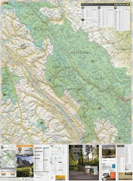
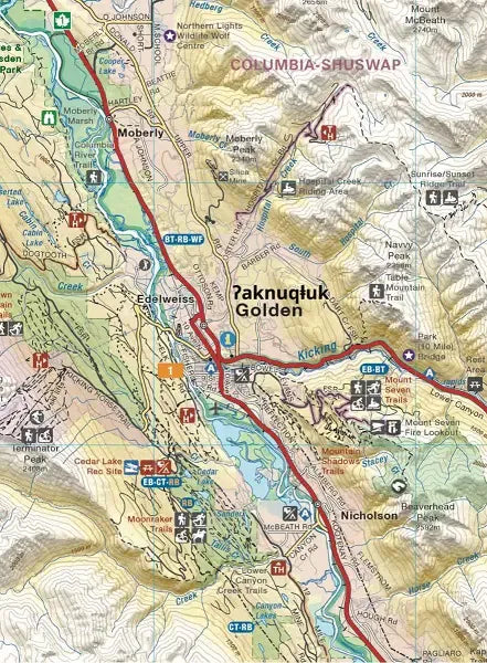
This waterproof recreation topographic map of the East Kootenays published by Backroads Maps spans the region's deep lakes, pristine rivers, majestic peaks, and expansive valleys.
From Radium Hot Springs' therapeutic waters to Fernie's mountain playground and the wilds of the Purcell Range, every adventure awaits exploration.
The map now extends north, encompassing Banff National Park in Alberta, Flathead areas, portions north of Golden, and a slice of the West Kootenays.
Printed on durable, water-resistant material, it brims with detailed cartography, serving as your ultimate companion in Canada's premier outdoor playground.
East Kootenay Backroads Recration Map Features:
- Printed on durable waterproof and tear-resistant material
- Includes industry leading cartographic detail and state-of-the-art relief shading
- Numerous updates and expansions from our last edition, including clearer definition of camping parks, RV sites, day-use sites, and private campgrounds
- Large-scale 86 x 166 cm (34 x 65.25 in) map derived from our Backroad Mapbooks at 1:200,000 scale
- Seamless map coverage requires no page turning
- UTM grids with latitude and longitude make navigating the map easy
- Detailed index for recreation sites, trails and provincial parks
- Labelled backroad attractions
- And much more!
SKU: SKU:MUS806594
View full details