International Travel Maps
Dublin & Ireland Travel Map
Dublin & Ireland Travel Map
Couldn't load pickup availability
Share
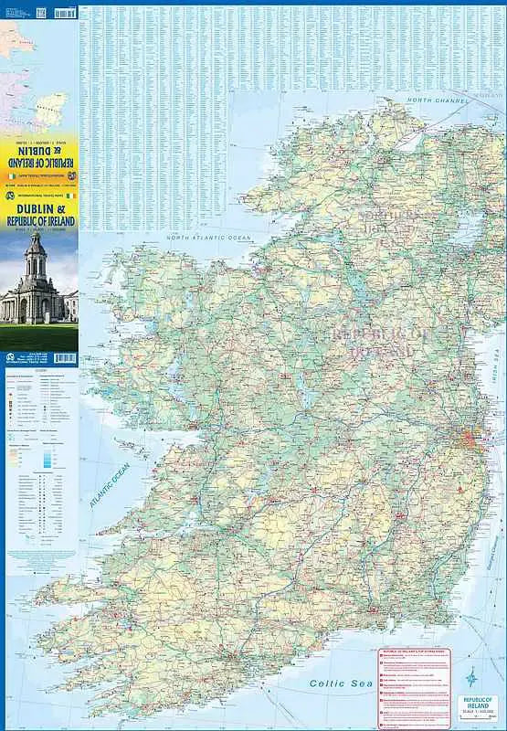
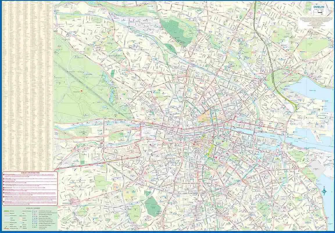
Published ITM - This Travel Road map of Dublin and the Republic of Ireland is two-sided for maximum detail!
Side A features a detailed city street map of Dublin. The River Liffey, of course, flows across the center of the page. The River Tolka marks the North Boundary while the Grand Canal holds the south. West boundary you'll find Phoenix Park and it stretches clear across to the Dublin Bay in the east. ITM conveniently shows Dublin's two rapid-transit tram lines for easy use. Parks, Hotels, Shopping Areas, Restaurants, Theaters, Embassies, the Ferry Terminal and much more are clearly labeled on this folded map. They also list The Top Attractions of Dublin!
Side B presents a very detailed travel map of the Republic (for convenience they do also have Northern Ireland - mostly Belfast - included on this map) of Ireland shoring all motorways, highways and secondary routes as well as rail lines! Tourist Attractions like Blarney Castle and the Rock of Cashel are highlighted.
SKU: SKU:ITMDUBLIN
View full details