National Geographic
Dominican Republic Adventure Travel Map by National Geographic
Dominican Republic Adventure Travel Map by National Geographic
Couldn't load pickup availability
Share
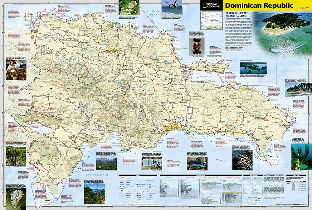
Discover the vibrant landscapes of the Dominican Republic with National Geographic’s Dominican Republic Adventure Travel Map, the ultimate companion for adventure seekers. This detailed, folded map highlights the country’s diverse geography—from the towering Pico Duarte in the Cordillera Central to the sun-soaked beaches of Punta Cana and the lush Samana Peninsula. Explore the historic streets of Colonial Santo Domingo, wander the remote trails of Del Este National Park, or marvel at the salt flats and flamingos of Lake Enriquillo.
The map includes a comprehensive road network, side tracks for off-the-beaten-path exploration, and hundreds of points of interest, from national parks and wildlife refuges to archeological sites and shipwrecks. Airports, ferry routes, and border crossings with Haiti are clearly marked, making navigation effortless. Printed on durable, waterproof synthetic paper, it can withstand even the wildest adventures. Fun fact: the Dominican Republic shares the island of Hispaniola with Haiti, making it one of only two Caribbean nations to share a land border.
ArticlesSKU: SKU:TRA3102
View full details