1
/
of
2
National Geographic
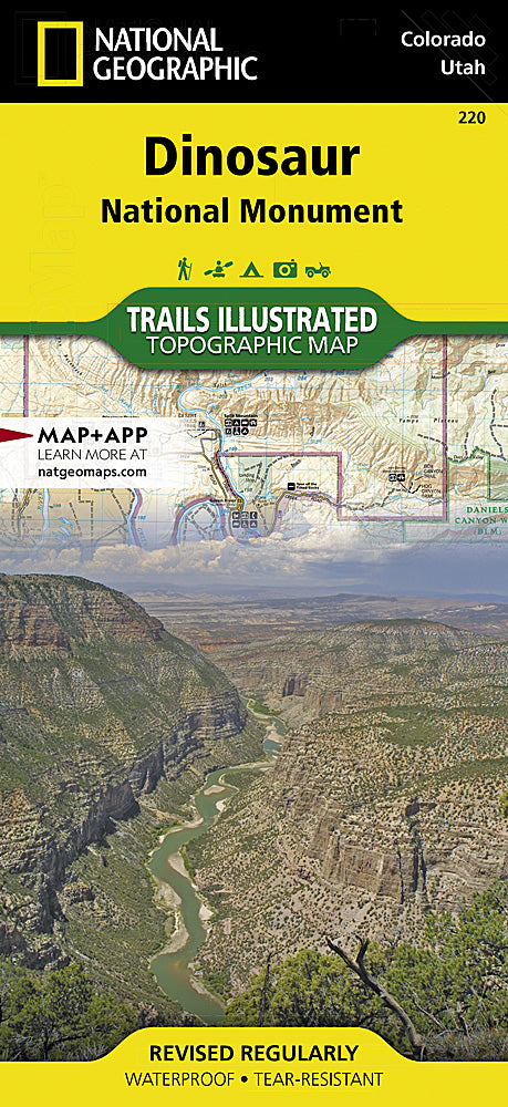
Dinosaur National Monument Trails Illustrated Topographic Map #220
Dinosaur National Monument Trails Illustrated Topographic Map #220
Regular price
$14.95 USD
Regular price
Sale price
$14.95 USD
Unit price
/
per
Couldn't load pickup availability
Share
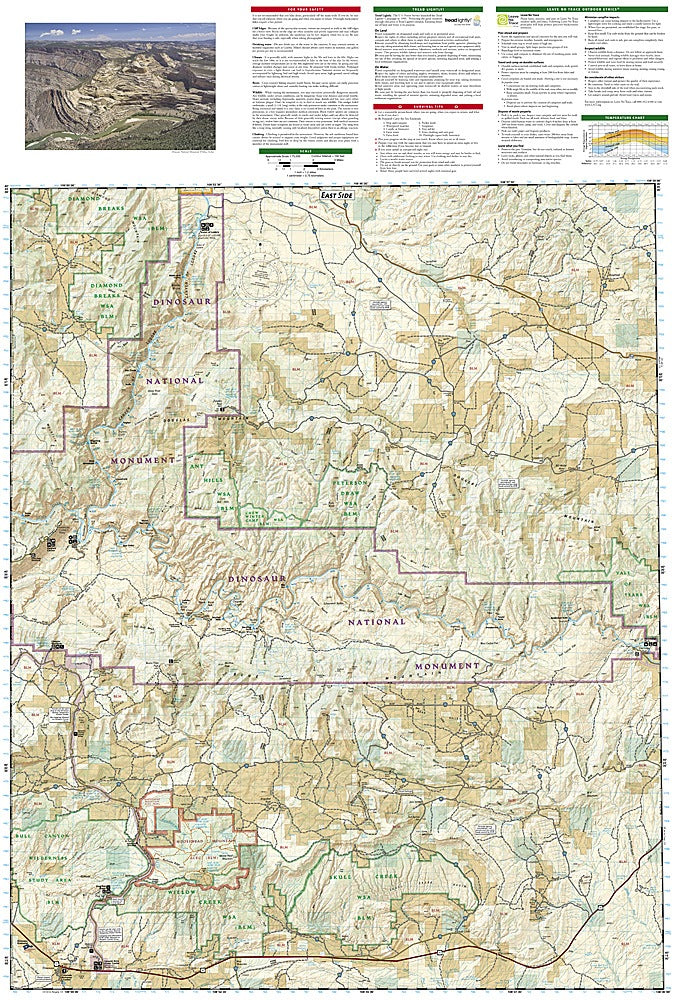
National Geographic’s Dinosaur National Monument Trails Illustrated Topographic Map #220 is your ultimate guide to exploring one of America’s most fascinating landscapes. Spanning northwest Colorado and northeast Utah, this map leads adventurers to incredible highlights like the world-famous Dinosaur Quarry, where fossilized giants come to life, the dramatic Canyon of Lodore, carved by the Green River, and Harpers Corner, offering sweeping panoramic views.
Rich in history, the monument preserves the legacy of prehistoric creatures while showcasing the rugged beauty of the Colorado Plateau. This detailed topographic map features shaded relief, elevations, color-coded trails, and clearly marked public lands, parks, and wildlife areas. Outdoor enthusiasts can navigate river campsites, fishing spots, scenic drives like the Dinosaur Diamond, and interpretive trails with ease.
Printed on waterproof, tear-resistant “Backcountry Tough” paper with a full UTM grid for GPS navigation, this map is an indispensable companion for hikers, paddlers, and explorers seeking adventure in this geologically and historically remarkable region.
Articles
SKU: SKU:TRA220
View full details