Rand McNally
Delaware & Maryland State Highway Folded Map by Rand McNally
Delaware & Maryland State Highway Folded Map by Rand McNally
Couldn't load pickup availability
Share
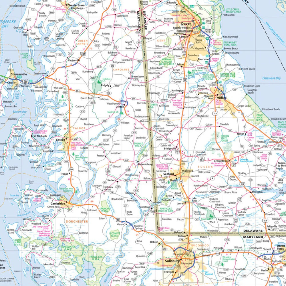
Hit the open road with confidence through the "First State" and the "Old Line State"! The Rand McNally Delaware & Maryland Easy to Read State Highway Map is your go-to travel companion for scenic drives, coastal escapes, and spontaneous detours. Unlike a screen that loses signal or glare, this foldable, full-color map gives you the whole picture—perfect for planning your next route or uncovering hidden gems like Assateague Island, where wild ponies roam free along the Atlantic shore.
With larger print, updated highways, and easy-to-follow legends, this map makes navigation simple and stress-free. It shows every Interstate, U.S., state, and county route, plus parks, airports, and must-see attractions at a glance. Whether you're exploring Chesapeake Bay’s backroads or heading for Delaware’s quiet beaches, this durable, budget-friendly map keeps your journey smooth, spontaneous, and screen-free—just the way road trips were meant to be.
SKU: SKU:RMCUSDE
View full details