SeaTrails
Deception Pass & Skagit Bay Paddling Map WA101
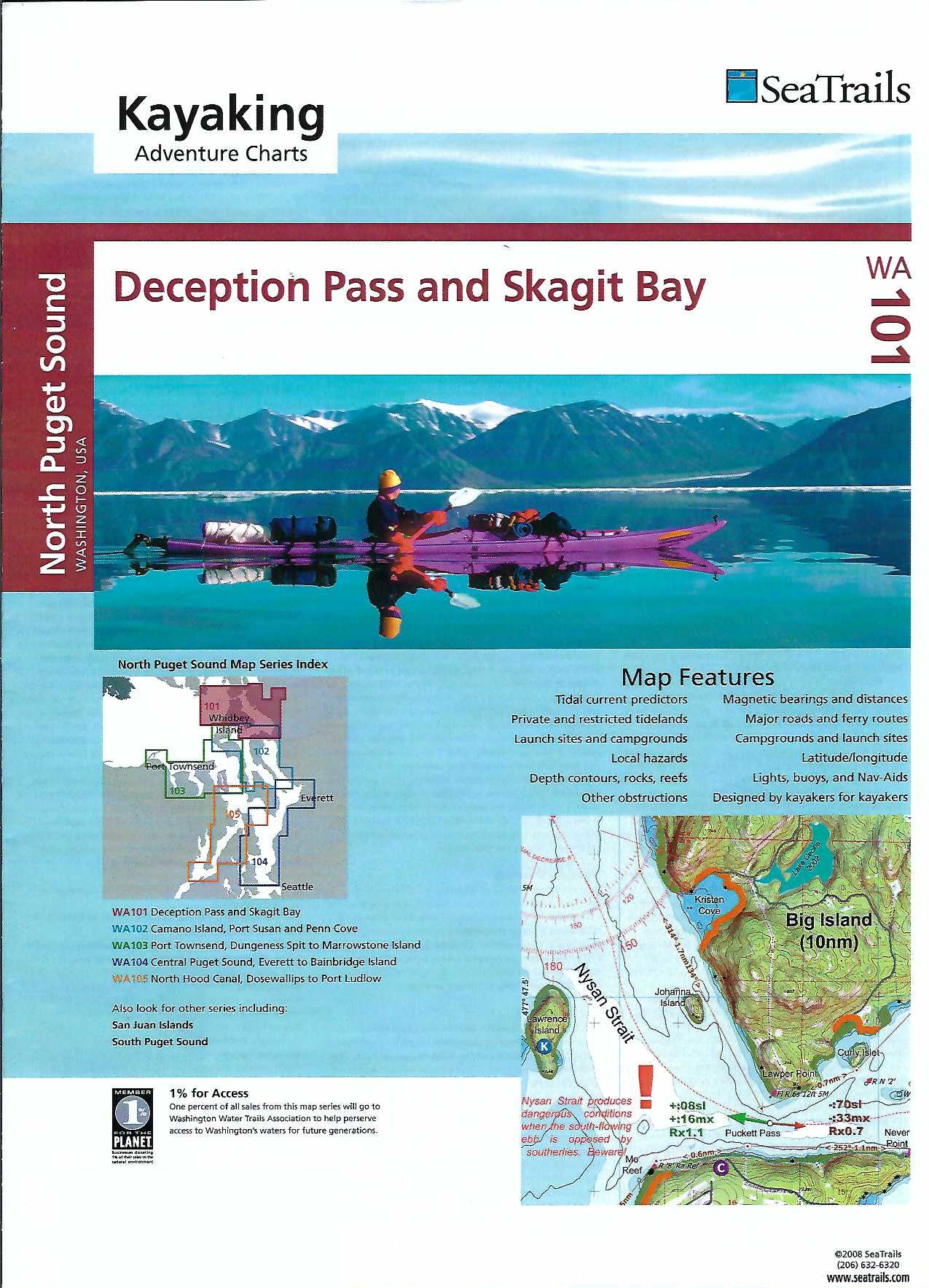
Deception Pass & Skagit Bay Paddling Map WA101
Couldn't load pickup availability
Share
The Deception Pass & Skagit Bay Kayaking Adventure Chart by SeaTrails is designed specifically for sea kayakers, this waterproof, compact map details public launch points, campsites, hazards, and navigational aids.
Paddle through the thrilling currents of Deception Pass, explore the serene beauty of Hope Island State Park, or drift along the sheltered waters of Similk Bay. Depth contours, buoy locations, and ferry routes help ensure safe and informed travel, while shoreline distances and bearings support seamless trip planning.
Whether you're seeking challenging tides or peaceful backwaters, this chart delivers the critical details you need on a kayak-friendly format built for adventure. Take the guesswork out of your journey and experience the coastline with confidence.
SKU: SKU:SEAWA101
View full details