National Geographic
Continental Divide Trail Great Treks Planning Map by Nat Geographic
Continental Divide Trail Great Treks Planning Map by Nat Geographic
Couldn't load pickup availability
Share
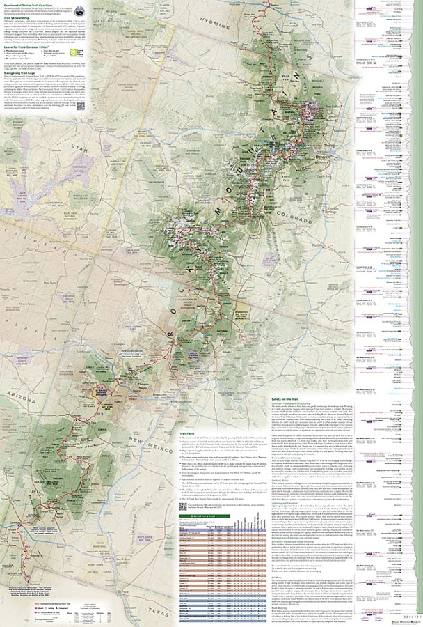
Plot your ultimate long-distance adventure with the Continental Divide Trail Great Treks Planning & Overview Map #5201 by National Geographic—your go-to guide for conquering one of North America’s most legendary hikes. From first mile dreams to thru-hike reality, this map turns big ambitions into doable plans.
Stretching 3,043 miles from the rugged deserts of New Mexico to the wild northern border of Montana, the Continental Divide Trail traces the spine of the Rockies, passing icons like Rocky Mountain National Park, Yellowstone National Park, and Glacier National Park. This historic route follows pathways shaped by Indigenous peoples, explorers, and early conservation efforts that helped define America’s wilderness.
Designed with hikers in mind, this National Geographic map lays out the entire CDT with section breakdowns, elevation profiles, resupply points, and key waypoints. Whether you're planning a weekend section hike or a full border-to-border trek, you’ll find everything from campsites to crossings clearly marked.
Printed on waterproof, tear-resistant paper with a full GPS-friendly grid, it’s built to handle every mile ahead.
SKU: SKU:TRA5201
View full details