The MapShop
Concrete Raised Relief Map
Concrete Raised Relief Map
Couldn't load pickup availability
Share
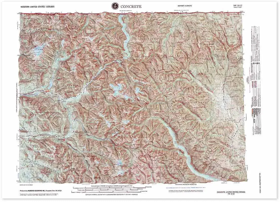
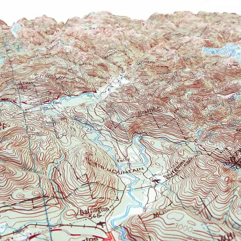
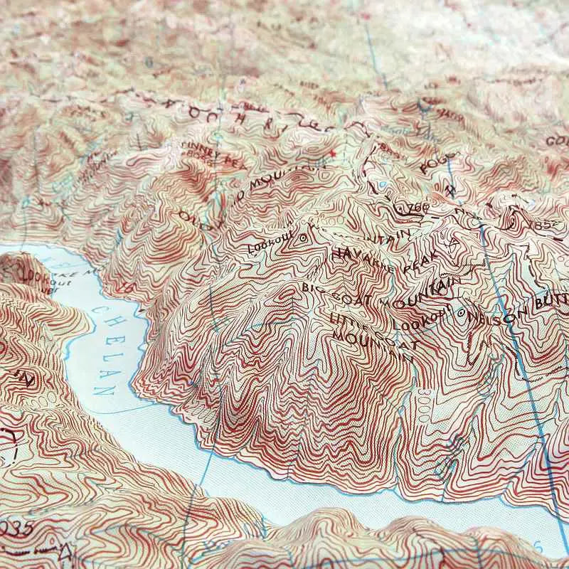
Concrete, WA Region Raised Relief Map: Explore the rugged beauty of the Concrete, WA region with this stunning raised relief map. Crafted with molded plastic, this detailed 3D map captures the essence of the area's mountainous terrain and notable geographic features with precision and artistry. Measuring 27" x 21" and featuring a scale of 1:250,000 (1" = 4 miles), it provides a clear and comprehensive view of this diverse landscape, including key peaks, lakes, and towns.
Concrete, WA Region Raised Relief Map Peaks & Ranges: Dominating the map are the awe-inspiring peaks of the North Cascades, including the majestic Mount Baker, which rises to 10,781 feet. This iconic volcano is a highlight, alongside the rugged terrain of the surrounding mountain ranges. The North Cascades National Park, renowned for its steep, glaciated peaks and alpine beauty, is vividly represented, offering a glimpse into one of Washington State's most spectacular natural landscapes.
Concrete, WA Region Raised Relief Map Geographic Features: This raised relief map offers intricate details of the region's significant geographic features. Ross Lake, a stunning reservoir surrounded by towering peaks, is prominently displayed, while Lake Chelan, known for its deep blue waters and surrounding vineyards, adds a touch of scenic contrast. The nearby town of Darrington, nestled among the trees and hills, is also highlighted, providing context to the local settlement amidst the vast wilderness. Rivers, lakes, mountains, and landmarks are all labeled, allowing for an easy and engaging exploration of the area's geography.
Raised Relief Maps are printed on vinyl and are not intended to roll and/or fold. We ship them in a flat box and pack them with love (i.e. Plenty of bubble wrap!)
SKU: SKU:TMSREGCONC
View full details