Mitchell Geography
Columbia River Watershed Reference Map
Columbia River Watershed Reference Map
Couldn't load pickup availability
Share
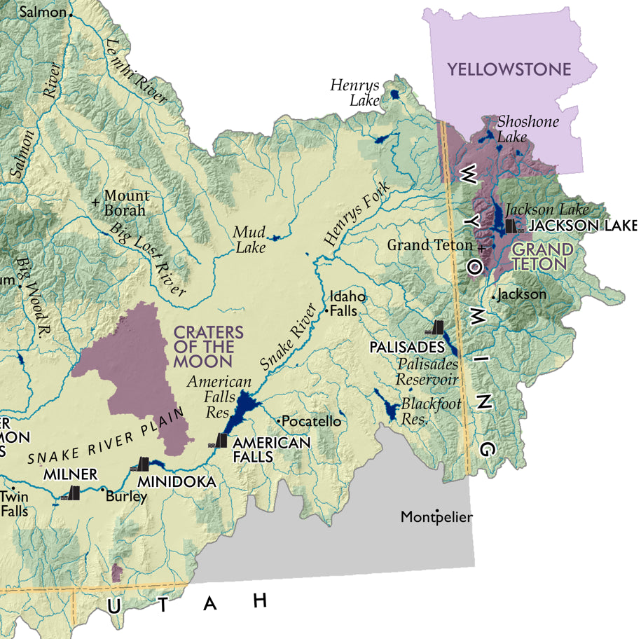
Follow the flow of one of North America’s most powerful river systems—this Columbia River Watershed Reference Map turns geography into a visual adventure you’ll want on your wall. Designed to captivate at a glance, it’s a must-have for map lovers, educators, and Pacific Northwest explorers.
Spanning the vast Columbia River basin across the U.S. and Canada, this 13" x 19" wall map showcases stunning color-shaded relief that brings mountains, valleys, and waterways to life on heavy fine paper. Trace the river from the Canadian Rockies through iconic destinations like Columbia River Gorge and the engineering marvel of Grand Coulee Dam. Rich in detail, it highlights national parks, wilderness areas, major dams, and hatcheries, including the extensive Bonneville Power Administration network.
Historically, the Columbia River powered Indigenous cultures for thousands of years before becoming central to hydroelectric expansion in the 20th century. This map captures that legacy while offering a clear, authoritative view of one of the continent’s most important watersheds.
SKU: SKU:PMGCRWA01
View full details