WoodChart
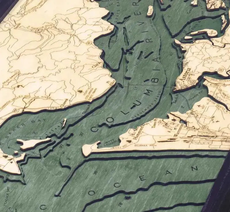
Columbia River Mouth Wood Chart
Columbia River Mouth Wood Chart
Couldn't load pickup availability
Share
Enjoy the stunning beauty and rich history of the Pacific Northwest with this Columbia River Mouth 3D Wood Chart. This exquisite piece of art intricately captures the confluence of the Columbia River as it meets the Pacific Ocean, showcasing the unique geographical features and storied place names of this iconic region. Whether you’re a history enthusiast, a lover of nature, or an admirer of fine craftsmanship, this chart is a perfect addition to your home or office.
Columbia River Mouth 3D Wood Chart points of interest include: the vast Lewis & Clark National Wildlife Refuge, where diverse ecosystems thrive; the charming city of Astoria, known for its Victorian-era homes and maritime heritage; the tranquil waters of Baker Bay; the scenic expanse of Long Beach; the historic Fort Columbia State Park, a testament to the area’s military significance; Puget Island, a serene community nestled in the river; and the boundless Pacific Ocean, which defines the region’s rugged coastline.
Columbia River Mouth Nautical Wood Chart color options: choose between a sophisticated Dark Brown Frame with Greenish Blue Water, perfect for adding a touch of elegance to any room, or a Rustic Grey Frame with Greyish Blue Water, which lends a more contemporary, coastal vibe to your décor.
Columbia River Mouth 3D Nautical Wood Chart production process: Each 31" x 13.5" chart begins with precise depth measurements from a bathymetric chart. Skilled artists then laser cut high-quality birch wood into pieces, layering and gluing them to accurately depict the varying depths and dimensions of the waterways. The water areas are meticulously hand-stained, while place names, points of interest, roads, and depths are intricately engraved into the surface. The chart is finished with a custom-sized wood frame and protected by a durable piece of acrylic glass, ensuring its longevity and your continued enjoyment.
SKU: SKU:MINCRM
View full details


