1
/
of
1
FishnMap
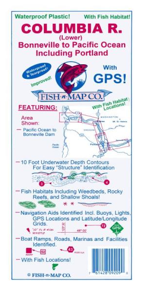
Columbia River (Lower) Fishing Map
Columbia River (Lower) Fishing Map
Regular price
$21.95 USD
Regular price
Sale price
$21.95 USD
Unit price
/
per
Couldn't load pickup availability
Share
Fish n' Maps are waterproof maps showing underwater topography or bathymetry.
They are printed on water-proof, tear-resistant plastic material and unfold to about 2' x 3' in size.
The maps feature information on fish species and suggested fishing locations. Boat ramp locations, fuel, lodging, campgrounds, and grocery stores are marked on the map, as well as RV hookups, showers and restrooms. The fishing maps are printed on both sides for maximum scale and readability.
SKU: SKU:FNMCOL
View full details