1
/
of
1
Green Trails
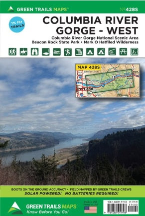
Columbia River Gorge West, OR - Green Trails Map 428S
Columbia River Gorge West, OR - Green Trails Map 428S
Regular price
$14.00 USD
Regular price
Sale price
$14.00 USD
Unit price
/
per
Couldn't load pickup availability
Share
Columbia River Gorge West, OR - Green Trails Map #428S covers the stunning Columbia River Gorge National Scenic Area, stretching from Troutdale and Washougal to Hood River and the White Salmon River.
Whether planning a scenic day hike through Oregon’s famous Waterfall Alley or a multi-day backpacking trip in the Mark O. Hatfield Wilderness, this detailed map is an essential companion. It includes the Washougal River Valley, Oxbow Regional Park, and Beacon Rock State Park, along with a section of the Pacific Crest Trail from Waucoma Ridge to Three Corner Rock.
Discover iconic hikes like Dog Mountain, Eagle Creek, and Angels Rest, as well as hidden gems such as Franklin Ridge, Augspurger Mountain, and Wygant Mountain.
Designed for accuracy and durability, this map is perfect for exploring the Columbia Gorge’s breathtaking landscapes.
SKU: SKU:GRE428S
View full details