National Geographic
Colorado Trail South Trails Illustrated Topographic Map Booklet #1201
Colorado Trail South Trails Illustrated Topographic Map Booklet #1201
Couldn't load pickup availability
Share
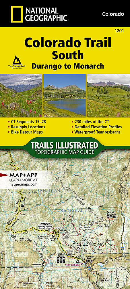
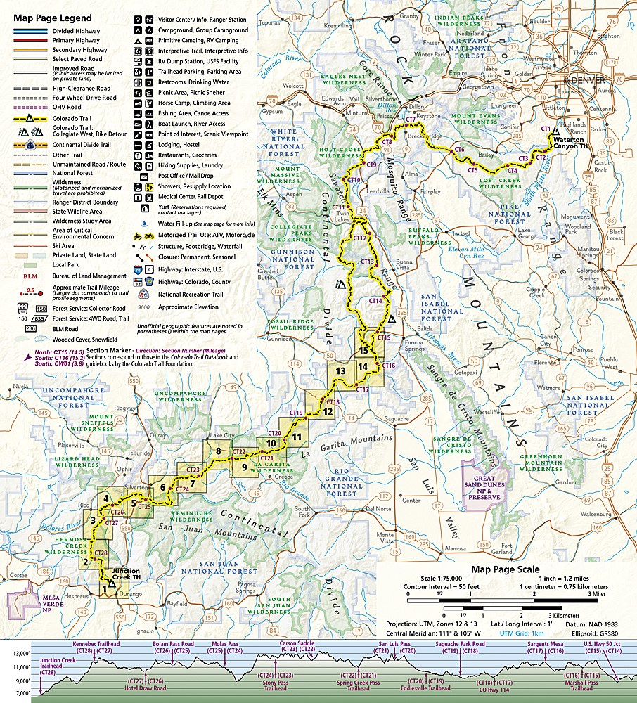
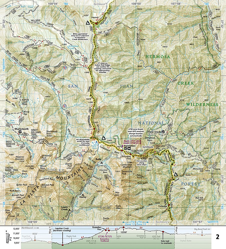
Explore Colorado’s wild beauty with National Geographic’s Colorado Trail South Trails Illustrated Topographic Map Booklet #1201. Covering the southern section of the legendary 486-mile trail from Denver to Durango, this map booklet is the ultimate trail companion. Hike through the dramatic San Juan Mountains, home to the trail’s highest point at 13,271 feet, and experience the unforgettable descent to the Animas River near Silverton. Discover alpine meadows and rugged ridgelines in the Sawatch Range, where the trail connects with the famed Collegiate Loop.
Rich with history, the Colorado Trail was envisioned in 1973 and completed in 1987, linking Colorado’s mining past with its outdoor adventure future. This durable, waterproof, and tear-resistant guide includes detailed topographic maps, resupply charts, bike detour routes, and trail profiles to track your journey mile by mile. Compact, lightweight, and “Backcountry Tough,” it’s the perfect resource for tackling Colorado’s premier long-distance hiking experience.
SKU: SKU:TRA1201
View full details