National Geographic
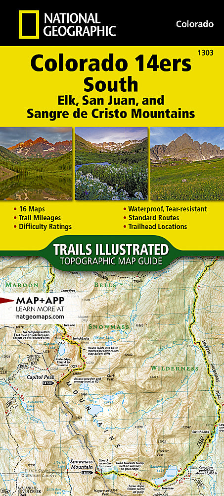
Colorado 14ers South Trails Illustrated Topographic Map Booklet #1303
Colorado 14ers South Trails Illustrated Topographic Map Booklet #1303
Couldn't load pickup availability
Share
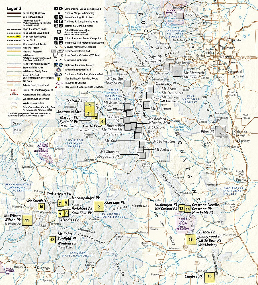
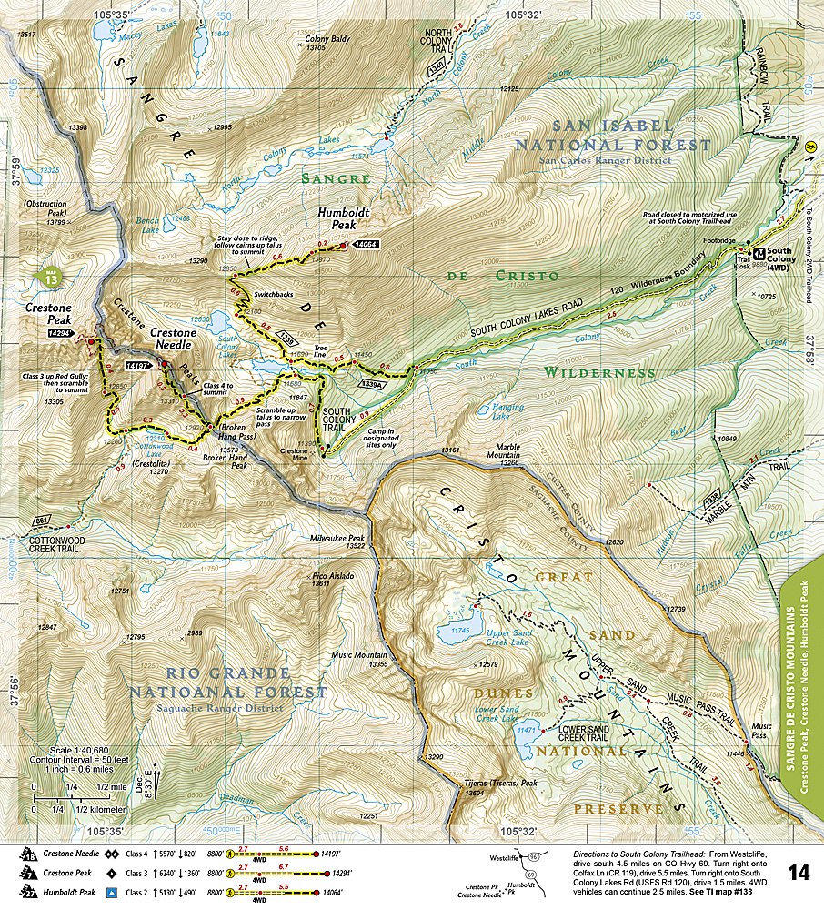
Take your high-altitude adventures to the next level with the Colorado 14ers South Trails Illustrated Topographic Map Booklet #1303 by National Geographic. Covering the dramatic Elk, San Juan, and Sangre de Cristo ranges, this compact guide provides detailed maps and essential trail data for southern Colorado’s legendary fourteeners. Plan your climbs of iconic peaks like the Maroon Bells, Capitol Peak, and Crestone Peak—each renowned for their rugged beauty and technical challenges.
Colorado’s southern mountains carry deep history as well. The San Juans were once at the heart of the state’s silver boom, while the Sangre de Cristos were named by Spanish explorers in the 1700s for their crimson glow at sunrise. Today, they attract climbers from around the world.
Printed on waterproof, tear-resistant paper, this lightweight booklet includes mileage, elevation, GPS grids, and 2WD/4WD trailhead access—everything you need to safely explore Colorado’s most demanding and breathtaking peaks.
- Waterproof/ Tear-resistant
- Scale 1:40,680 & 1: 63,360
- Booklet Format
SKU: SKU:TRA1303
View full details