National Geographic
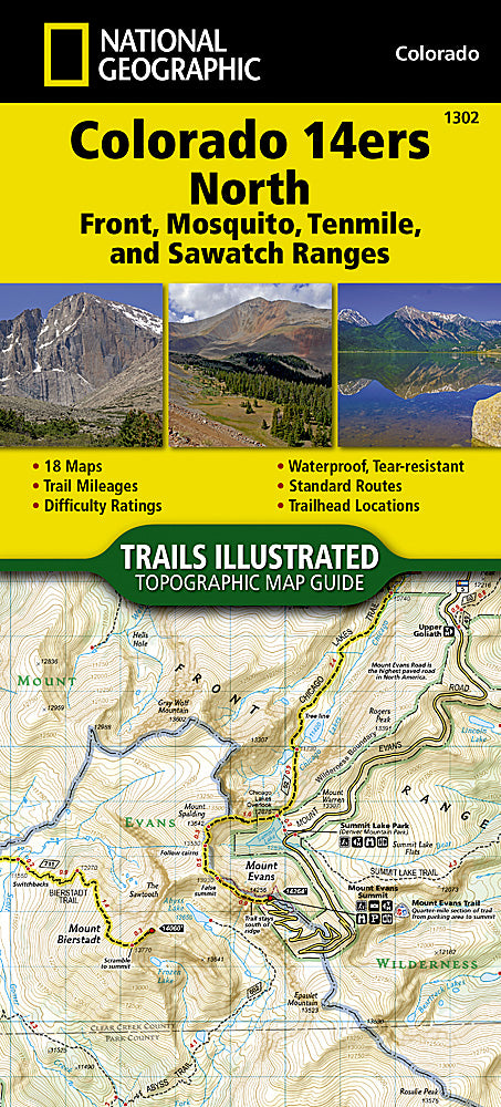
Colorado 14ers North Trails Illustrated Topographic Map Booklet #1302
Colorado 14ers North Trails Illustrated Topographic Map Booklet #1302
Couldn't load pickup availability
Share
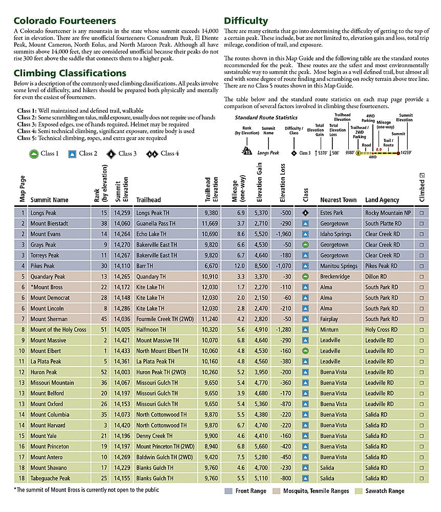
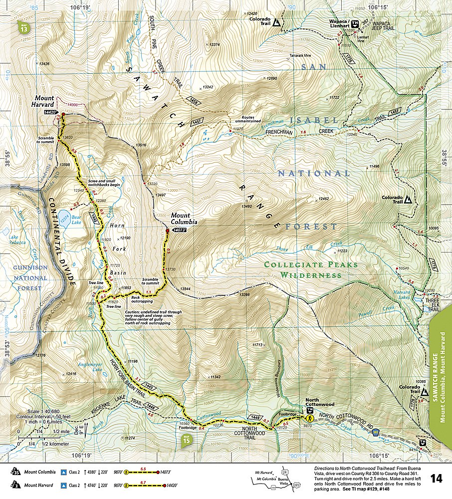
The Colorado 14ers North Trails Illustrated Topographic Map Booklet #1302 by National Geographic is the ultimate guide for adventurers seeking to conquer the legendary peaks of northern Colorado. Covering the Front, Mosquito, Tenmile, and Sawatch ranges, this compact booklet details nearly half of Colorado’s famed 14,000-foot summits. Explore iconic climbs like Longs Peak in Rocky Mountain National Park, the dramatic ridges of La Plata Peak, or the accessible yet breathtaking Mount Evans, one of the few fourteeners with a paved road to its summit.
Colorado’s history is deeply tied to these peaks, from Indigenous peoples who revered them to miners of the 1800s who carved early routes through their slopes. Today, the 14ers continue to inspire both seasoned mountaineers and first-time climbers.
Printed on waterproof, tear-resistant paper, this lightweight map guide delivers accurate routes, mileage, elevation profiles, and GPS-ready grids—making it a must-have companion for your next alpine adventure.
- Booklet Format
- Waterproof/ Tear-resistant
- Scale 1: 40,680 & 1: 63,360
SKU: SKU:TRA1302
View full details