National Geographic
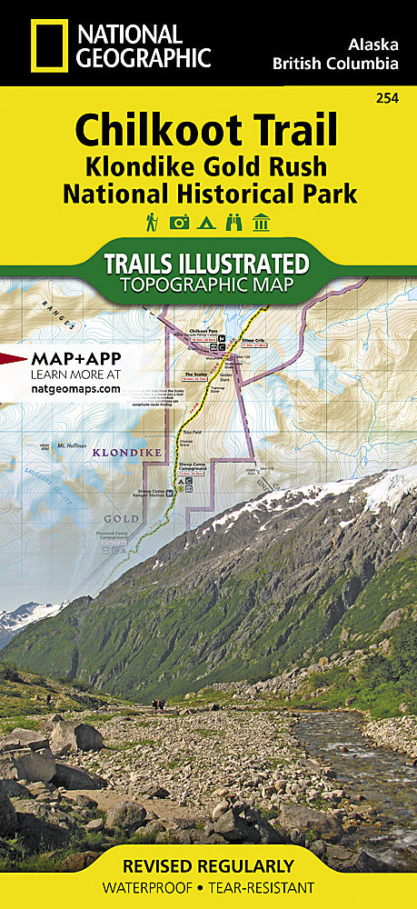
Chilkoot Trail/Klondike Gold Rush Trails Illustrated Topo Map #254
Chilkoot Trail/Klondike Gold Rush Trails Illustrated Topo Map #254
Couldn't load pickup availability
Share
National Geographic’s Chilkoot Trail/Klondike Gold Rush Trails Illustrated Topographic Map #254 is the ultimate guide for exploring one of North America’s most legendary routes. Covering the rugged Alaskan panhandle, this waterproof and tear-resistant map highlights the Chilkoot Trail National Historic Site, the Klondike Gold Rush National Historical Park, and the bustling historic town of Skagway.
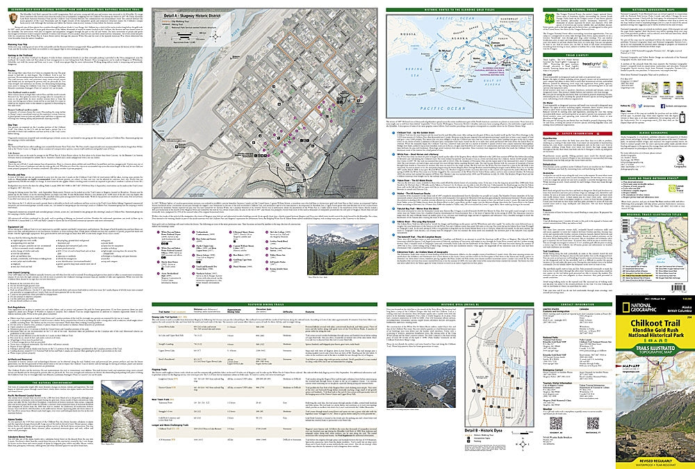
Hike through Dyea, once a booming gold rush settlement, or trek to Happy Camp, a remote backcountry highlight along the trail. The map also details stunning natural features like Bennett, Lindeman, and Crater Lakes, offering both breathtaking scenery and rich historical context. Insets showcase gold rush-era routes, the Skagway Historic District, and the remnants of Historic Dyea, transporting you back to the days of stampeders seeking fortune.
With trail profiles, safety tips, and GPS-ready UTM grids, this map is perfect for hikers, history buffs, and adventurers eager to follow in the footsteps of gold seekers.
SKU: SKU:TRA254
View full details