The Cascadia Institute
Cascadia Bioregion Wall & Reference Map
Cascadia Bioregion Wall & Reference Map
Couldn't load pickup availability
Share
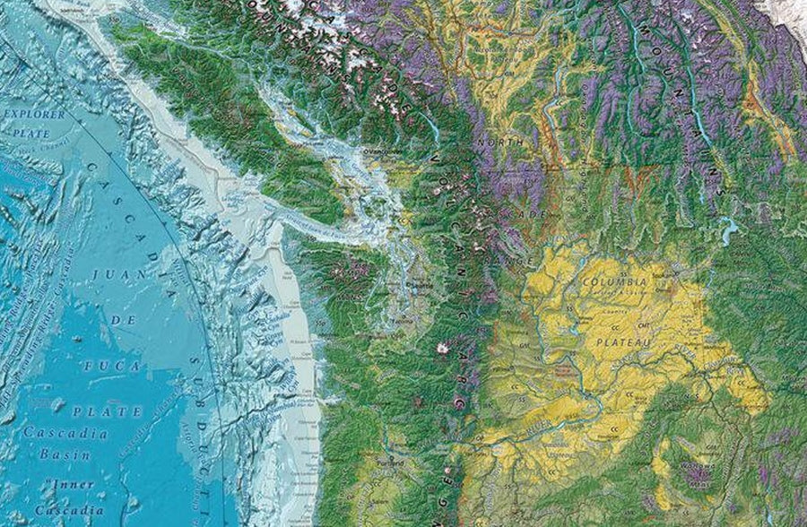
See the Pacific Northwest like never before with this stunning Cascadia Bioregion Wall & Reference Map—where ecology, geography, and beauty collide. It’s not just a map, it’s a visual story of one of North America’s most dynamic natural regions.
Measuring 27" x 39" and available paper or laminated, this richly detailed wall map highlights rivers, lakes, mountain ranges, and major place names with elegant terrain shading across land and water. It goes beyond borders, showcasing the true ecological footprint of Cascadia—from Northern California to Alaska and inland toward the Continental Divide. Vibrant land cover data reveals forests, grasslands, agriculture, and urban zones, offering a layered understanding of how the region functions.
Explore interconnected ecosystems, smaller bioregions, and even the dramatic Cascadia Subduction Zone beneath the Pacific. Designed to emphasize natural systems over political lines, this map provides a rare, cohesive perspective perfect for educators, travelers, and nature enthusiasts alike.
ArticlesSKU: SKU:CIOCASP
View full details