1
/
of
1
National Geographic
Caribbean Wall Map by National Geographic
Caribbean Wall Map by National Geographic
Regular price
$29.95 USD
Regular price
Sale price
$29.95 USD
Unit price
/
per
Couldn't load pickup availability
Share
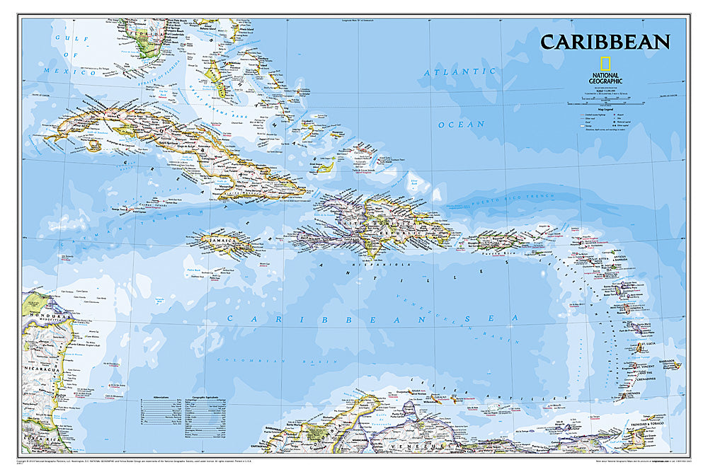
The Caribbean Wall Map by National Geographic is a vibrant and detailed reference for exploring one of the world’s most captivating regions. Spanning from Florida’s southern tip to Colombia and Venezuela, and from Barbados to the eastern edges of Central America, this map captures the Caribbean’s beauty and diversity in stunning clarity.
Intricate bathymetric shading reveals undersea wonders, including the dramatic Puerto Rico Trench, the Atlantic’s deepest point at 8,605 meters (28,232 feet). Over 1,000 labeled locations showcase capitals, towns, political boundaries, major infrastructure, and notable landforms. Informative notes scattered across the map bring the region’s rich history and unique geography to life—from colonial heritage to volcanic island chains.
Perfect for classrooms, offices, or home décor, this 36" x 24" map is available in paper or durable laminated formats, making it both a learning tool and an eye-catching centerpiece for anyone fascinated by the Caribbean’s allure.
Articles
SKU: SKU:NGSCAR
View full details