International Travel Maps
Caribbean Cruising Travel Map
Caribbean Cruising Travel Map
Couldn't load pickup availability
Share
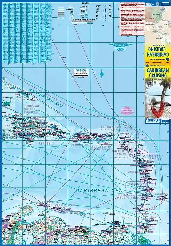
The Caribbean Sea is one of the most popular cruising destinations in the world.
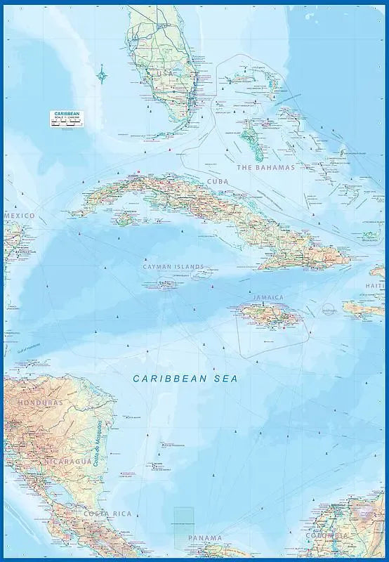
This colorful double-sided map of the Caribbean published ITMB starts just north of Orlando/Tampa in order to show the northernmost Bahamian islands and south as far as the Panama Canal at Colon and the coast of Venezuela. The map shows good detail for each island and the legal boundaries of each island nation. Side 1 concentrates on the western Caribbean, essentially the Bahamas, Cuba, Jamaica, and the Cayman Islands.
Side 2 covers the eastern islands such as Hispaniola (Haiti and the Dominican Republic), Puerto Rico and the US and British Virgin Islands, Turks & Caicos, and the Lesser Antilles chain of island countries, such as Antigua, Guadeloupe, Barbados, and Trinidad/Tobago, among others. Coverage then extends westward along the Venezuelan coastline to include the Dutch possessions of Aruba, Bonaire, and Curacao.
The most popular cruise line routes are shown; most start either from Puerto Rico or from southern Florida.
SKU: SKU:ITMCARIB
View full details