NOAA
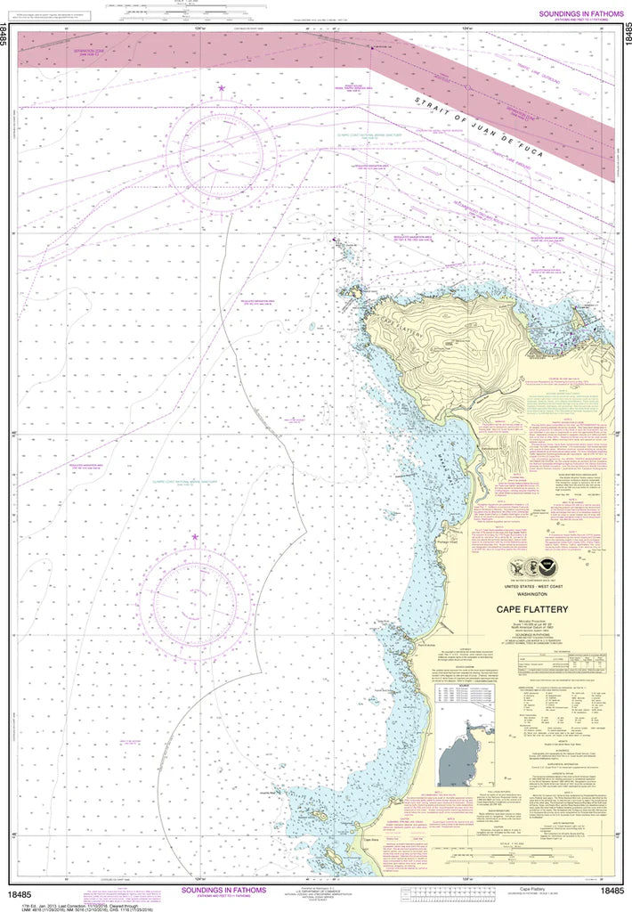
Cape Flattery Nautical Chart #18485
Cape Flattery Nautical Chart #18485
Couldn't load pickup availability
Share
Adventure begins where the Pacific meets the rugged Northwest! The Cape Flattery Nautical Chart #18485 is your gateway to one of the most spectacular stretches of coastline in the United States.
Covering the dramatic waters surrounding Cape Flattery, this detailed NOAA nautical chart includes Neah Bay, Tatoosh Island, the entrance to the Strait of Juan de Fuca, and nearby Pacific coastal waters. Boaters, sailors, anglers, kayakers, and chart collectors will appreciate the incredible detail of this iconic maritime region. Measuring 33" x 44" with a 1:40,000 scale, it's large enough for easy viewing while showcasing intricate shoreline features, navigation aids, soundings, and coastal landmarks.
Cape Flattery marks the northwesternmost point of the contiguous United States and has guided mariners for centuries. The nearby Tatoosh Island Lighthouse, first illuminated in 1857, played a vital role in helping vessels safely navigate these often foggy and challenging waters. Whether displayed on your wall or added to your chart collection, this classic nautical chart celebrates the rich maritime heritage and breathtaking beauty of the Pacific Northwest.
(View more detail in nautical chart viewer)
Please note: For decorative and reference purposes only, NOAA has officially sunset traditional paper nautical charts. These legacy charts are no longer updated or approved for primary navigation.
SKU: SKU:NOS18485
View full details