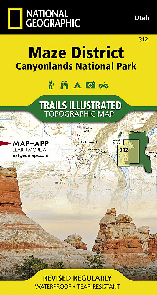
National Geographic
Canyonlands NP Maze District Trails Illustrated Topographic Map #312
Canyonlands NP Maze District Trails Illustrated Topographic Map #312
Couldn't load pickup availability
Share
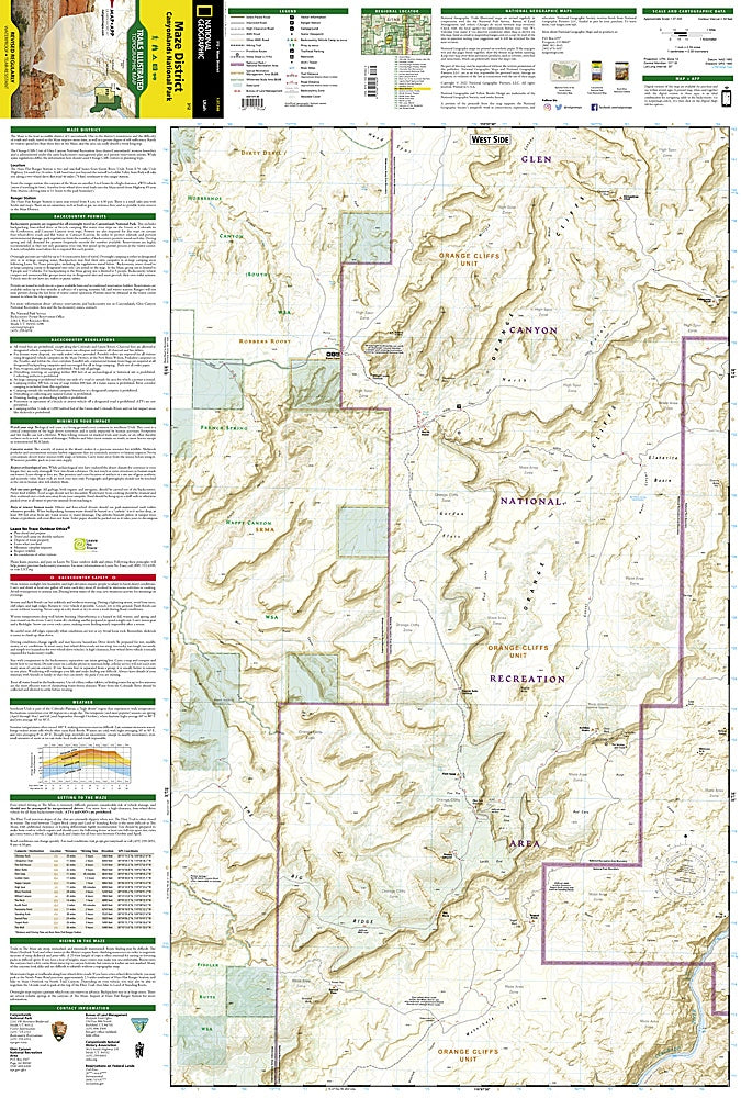
Discover the rugged beauty of Canyonlands National Park’s Maze District with National Geographic’s Trails Illustrated Map #312. This remote and awe-inspiring corner of Utah is a paradise for adventurous explorers seeking solitude among dramatic landscapes. Navigate the twisting channels of the Colorado and Green Rivers, marvel at the towering spires of the Land of Standing Rocks, and explore the orange-hued cliffs and deep canyons of Horseshoe and Cataract Canyons. Rich in history, the Maze District holds evidence of ancient Puebloan inhabitants and early explorers who braved its challenging terrain.
Expertly designed with contour lines, elevations, and road classifications, this map highlights everything from high-clearance 4x4 routes to mountain biking trails color-coded by difficulty. Key recreation features such as campgrounds, boat launches, scenic overlooks, and trail summaries make planning easier. Printed on waterproof, tear-resistant paper with a full UTM grid, it’s the ultimate tool for safely discovering this remote, unforgettable landscape.
SKU: SKU:TRA312
View full details