National Geographic
Canyonlands NP Island in the Sky District Trails Illustrated Map #310
Canyonlands NP Island in the Sky District Trails Illustrated Map #310
Couldn't load pickup availability
Share
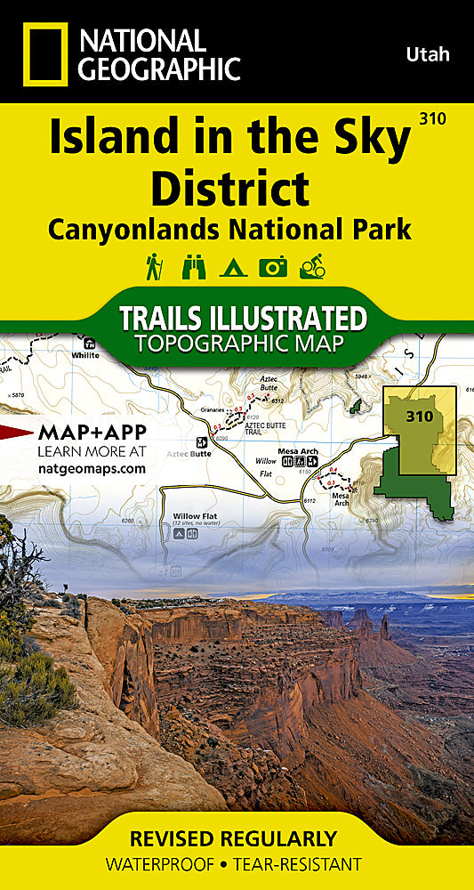
Discover the breathtaking vistas of Canyonlands National Park’s Island in the Sky District with National Geographic’s Trails Illustrated Map #310, the ultimate companion for adventurers and sightseers alike. Perched atop towering mesas, this district offers iconic attractions like Grand View Point, where sweeping canyon panoramas stretch for miles; Dead Horse Point State Park, a dramatic overlook with a storied history of wild mustangs; and the rugged White Rim Road, perfect for a scenic drive or mountain biking adventure.
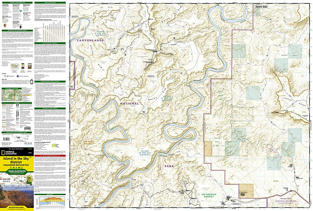
The map provides precise topographic details, including contour lines, elevations, and trail distances, plus river mileage along the Green and Colorado Rivers for boaters exploring the area. Road types and bike route difficulties are clearly marked, while campgrounds, picnic areas, scenic overlooks, and key points of interest are easily identified. Printed on waterproof, tear-resistant paper with a full UTM grid, this Trails Illustrated map ensures safe, informed, and unforgettable exploration of one of Utah’s most spectacular landscapes.
SKU: SKU:TRA310
View full details