Canadian Hydrographic Service (CHS)
Canadian Nautical Chart #3685 - Tofino
Canadian Nautical Chart #3685 - Tofino
Couldn't load pickup availability
Share
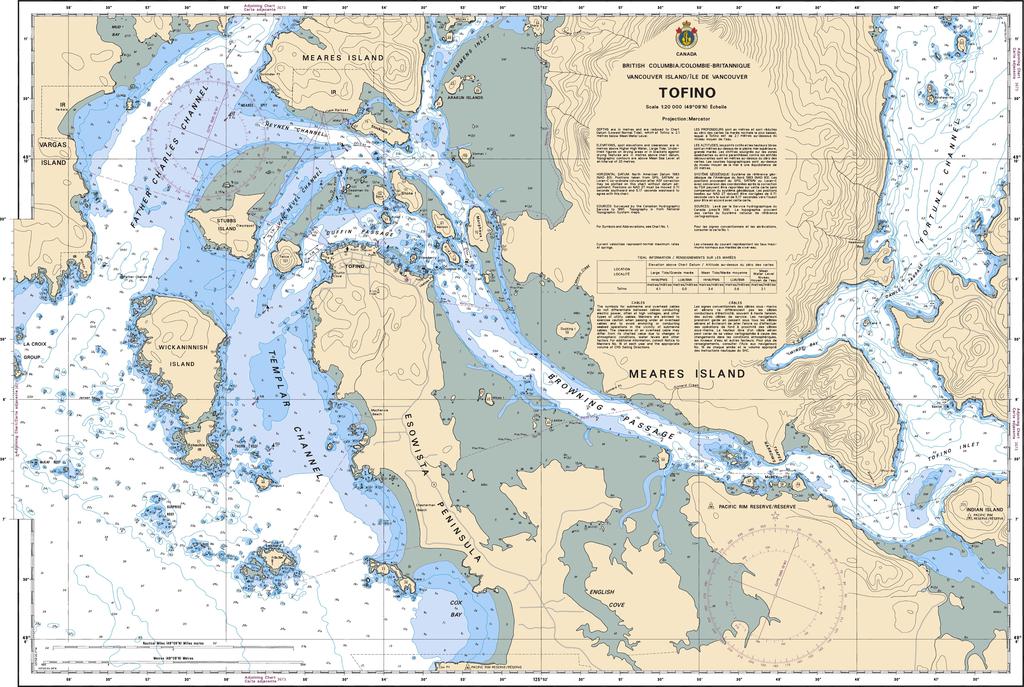
Chart a course to one of British Columbia’s most spectacular coastal destinations! Canadian Nautical Chart #3685 – Tofino is the perfect blend of trusted marine navigation, coastal history, and stunning wall-worthy décor.
Covering the rugged waters surrounding Tofino at a detailed scale of 1:20,000, this official Canadian Nautical Chart maps the intricate coastline, Clayoquot Sound, Vargas Island, Meares Island, Wickaninnish Island, Chesterman Beach, and the numerous channels, inlets, reefs, and anchorages that make this region a favorite among boaters, kayakers, anglers, and adventurers. Measuring a generous 36" x 26", it offers exceptional detail for trip planning, navigation reference, or display.
Tofino's maritime history stretches back thousands of years as the traditional homeland of the Tla-o-qui-aht First Nation before becoming an important hub for fishing, logging, and Pacific Coast exploration. Today, its wild coastline continues to attract mariners from around the world.
Whether you're planning your next voyage, remembering an unforgettable adventure, or decorating a home, office, or cabin with authentic nautical style, Canadian Nautical Chart #3685 - Tofino is a timeless piece that celebrates one of Canada's most breathtaking stretches of coastline while inspiring every future expedition.
SKU: SKU:CHY3685
View full details