Canadian Hydrographic Service (CHS)
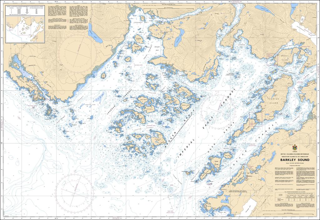
Canadian Nautical Chart #3671 - Barkley Sound
Canadian Nautical Chart #3671 - Barkley Sound
Couldn't load pickup availability
Share
Adventure begins the moment you unroll Canadian Nautical Chart #3671 – Barkley Sound! Whether you're plotting your next voyage or creating a coastal-inspired display, this detailed chart brings one of British Columbia's most spectacular marine playgrounds to life.
At a scale of 1:40,000 and a generous 48" x 36" size, Canadian Nautical Chart #3671 covers the intricate waterways of Barkley Sound, including the famous Broken Group Islands, Bamfield, Ucluelet approaches, Trevor Channel, and numerous sheltered anchorages prized by boaters, kayakers, anglers, and paddlers. The region holds an important place in Canadian history as the gateway to the historic West Coast Trail, established after the tragic 1906 wreck of the steamship Valencia highlighted the need for safer coastal travel.
Perfect for both exploration and decoration, this beautifully detailed nautical chart is an excellent planning companion for mariners while also serving as striking coastal wall art for homes, cabins, offices, or yachts. Celebrate the rugged beauty, rich maritime heritage, and unforgettable scenery of Vancouver Island's wild west coast with this timeless Canadian nautical chart.
SKU: SKU:CHY3671
View full details