Canadian Hydrographic Service (CHS)
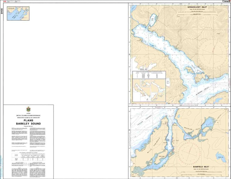
Canadian Nautical Chart #3646 - Plans Barkley Sound
Canadian Nautical Chart #3646 - Plans Barkley Sound
Couldn't load pickup availability
Share
Discover the rugged beauty of British Columbia’s coast with Canadian Nautical Chart #3646 - Plans Barkley Sound, a stunning chart that turns marine exploration into a wall-worthy adventure. Whether you’re a boater, coastal explorer, or ocean lover, this detailed nautical chart brings the shoreline to life.
This revised Canadian nautical chart focuses on the intricate waters of Uchucklesit and Bamfield Inlets, highlighting the channels, coves, and coastal details that make this area a favorite among mariners. Located on Vancouver Island’s west coast, Barkley Sound has a rich maritime history, including the historic voyage of Captain James Cook’s exploration of the Pacific Northwest in 1778, which helped put this dramatic coastline on the map.
Perfect for navigation reference, coastal planning, or unique nautical décor, this chart makes a memorable gift for sailors, fishermen, and lovers of British Columbia’s wild shores. Measuring 41" x 36" with a scale of 1:18,000, Canadian Nautical Chart #3646 captures the spirit of adventure found along one of Canada’s most spectacular marine landscapes.
SKU: SKU:CHY3646
View full details